|
|
|

|
BOOK OF ABSTRACTS
INTRODUCTION
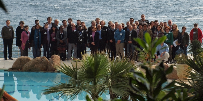
Participants of the Conference.
Conference Rationale: Extreme geohazards are the cause of major disasters. Most of the lives and property lost to disasters caused by geohazards are lost during extreme events. Although extreme geohazards are infrequent and restricted to certain geographical regions, their potential impact is huge and of global scale. For example, the 1755 Lisbon earthquake had a profound impact on European philosphy, culture and art (see also for example the many pieces of art in the Jan Kozak Collection). The global and long-lasting societal and economic impacts of the 2004 Sumatra and 2011 Japan earthquakes and associated tsunamis illustrate the scale of disasters caused by extreme geohazards, and they reminded us of the challenge of these extreme events for disaster risk management. At the same time, the recent major geohazards with global impacts are dwarfed by the largest geohazards that occurred during the last few millenniums. The potential impact on our civilization of any such rare event tends to be ignored in our planning of land use and infrastructure. Understanding the full spectrum of extreme geohazards is a prerequisite for disaster risk management and increased global resilience to these events. Reducing the disasters induced by the occurrence of extreme hazards at an acceptable economic cost requires a solid scientific understanding of the hazards. The recent disasters revealed gaps in the knowledge available for policy and decision making. It was therefore timely to review our understanding of extreme geohazards and to relate this knowledge to the full risk management cycle.
Conference Goals: The conference aimed to review the state-of-the-art of our understanding of extreme geohazards and to identify the most urgent scientific challenges that hinder the application of our knowledge of hazards to risk management. A main outcome of the conference is a declaration with a list of actions that would help to ensure that the scientific challenges are addressed in a timely manner and that the resulting information is communicated to policy and decision makers at an actionable level.
Heritage: The conference is a continuation of the series of international workshops on geohazards organized by the Geohazards Theme of the Integrate Global Observation Strategy Partnership (see http://igosg.brgm.fr/workshops_meetings.asp for details on the workshops). The second of these workshops took place in 2005 in Orleans, France, and the last one, the third, in 2007 in Frascati, Italy. This last workshop accepted the so-called Frascati Declaration, which, among others, recommended the Supersite Initiative. This initiative focuses on areas which have the potential to generate extreme geohazards. For these areas, the initiative promotes free exchange of all relevant data, including both in situ, airborne, and spaceborne observations, and the availability of the data for scientific studies. The identification of supersite locations and the implementation of the concept are important steps towards better scientific support for managing the risks of extreme geohazards.
Participation: The conference is open to all scientists and experts in geohazards and disaster risk management. If you are interested in participating, please, submit the Application Form.
CONFERENCE PROGRAM
Sunday, November 27, 2011
| 1600 - 1830: | Arrival/Registration |
| 1930 - 2000: | Welcome Drinks |
| 2000 - 2130: | Dinner |
Monday, November 28, 2011
| 0900 - 1045: | Opening Session. Co-Chairs: Stuart Marsh and Hans-Peter Plag |
| 0900 - 0905: | Hans-Peter Plag: Opening (text; video) |
| 0905 - 0925: | ESF (Paola Campus) : The European Science Foundation (presentation; video) |
| 0925 - 0935: | UNESCO (Robert Missotten): Welcoming address (video of the welcoming notes) |
| 0935 - 0945: | GEO (Francesco Gaetani): Welcoming address (address) |
| 0945 - 0955: | ICSU (Jane Rovins) : Welcoming address (address) |
| 0955 - 1000: | IGCP 585 (Roger Urgeles): Welcoming address (text) |
| 1000 - 1045: | Keynote Seth Stein, Robert Geller, Mian Liu: Bad Assumptions or Bad Luck: Why Natural Hazard Maps Fail and What To Do About It? (Abstract; presentation, ppt; video) |
| 1045 - 1115: | Coffee Break |
| 1120 - 1330: | Session 1: Extreme geohazards: What we know and potentially do not know. Co-Chairs: Seth Stein and Ivan Wong |
| 1120 - 1155: | Invited Brian G McAdoo: Offshore Geohazards and Risk Onshore- How Science can Contribute to Coastal Disaster Risk Reduction (abstract; presentation, prezi, video) |
| 1155 - 1235: | Invited Daniela Pantosti: Paleoseismology: reading the geological book in search for earthquakes and tsunamis of the past (abstract; presentation, pptx; video) |
| 1235 - 1300: | Robert Muir-Wood: The 'M9 Conundrum' - why the most critical earthquakes are also the most illusive (abstract; presentation, ppt; video) |
| 1300 - 1330: | Ron Harris: Reoccurrence of extreme geophysical events in Indonesia (abstract; presentation, pptx; video; School Case Study; Schools Education/Safety; Microzonation, Bogota) |
| 1300 - 1430: | Lunch |
| 1445 - 1600: | Session 2: Preparing for the extreme: quantifying the probabilities and uncertainties of extreme hazards. Co-Chairs: Roger Urgeles and Daniela Pantosti |
| 1445 - 1520: | Invited Ivan Wong: How Big, How Bad, How Often: Are Extreme Events Accounted for in Modern Seismic Hazard Analyses? (abstract; presentation, pptx; video) |
| 1520 - 1550: | Invited Carl Bonnevie Harbitz: Tsunamis caused by submarine landslides (abstract; presentation, pdf; video) |
| 1550 - 1600: | Discussion: How can science better address the uncertainties of the extreme events? See Questions/Statements. |
| 1600 - 1630: | Coffee Break |
| 1630 - 1800: | Session 3: Preparing for the extreme: costs of preparation versus costs of disasters. Co-Chairs: Alik Ismail-Zadeh and Robert Muir-Wood |
| 1630 - 1700: | Invited Gero Michel: Understanding and Managing Extreme Event Risk: The Insurance Industry (abstract; presentation, pptx; video) |
| 1700 - 1720: | Maria Bostenaru Dan: The economic impact of seismic retrofit on heritage buildings with historic reinforced concrete skeleton structure of the interwar time (abstract; presentation, ppt; video) |
| 1720 - 1740: | Shelley-Ann Jules-Plag and Hans-Peter Plag: Are building codes consistent with our evolving knowledge of geohazards? (abstract; presentation,ppt; video) |
| 1740 - 1800: | Youcef Bouhadad: Occurrence and impact of characteristic earthquakes in northern Algeria (abstract; presentation, pdf) |
| 1900 - 2100: | Dinner |
Tuesday, November 29, 2011
| 0900 - 1045: | Session 4: Predicting increased risks for extreme hazards: earthquakes . Co-Chairs: Gero Michel and Rui Pinho |
| 0900 - 0930: | Invited Alik Ismail-Zadeh: Modeling and Predicting Extreme Seismic Events (Abstract; presentation, ppt; video) |
| 0930 - 0950: | Álvaro González: Empirical forecasts of the occurrence of earthquakes in space (Abstract, ; video) |
| 0950 - 1010: | Suleyman Sami Nalbant: Long-term stress modelling: Implications for large earthquake forecasting (Abstract; video) |
| 1015 - 1045: | Discussion: Towards a time-variable view on probability? See Questions/Statements. |
| 1045 - 1115: | Coffee Break |
| 1115 - 1300: | Session 5: Predicting increased risks for extreme hazards: volcanoes and landslides. Co-Chairs: Brian Mc Adoo and Carl B. Harbitz |
| 1115 - 1145: | Invited Roger Urgeles, A. Camerlenghi, F. Palmer: Controls, timing, and characteristics of submarine landslides in the Mediterranean area as an example of science support for preparedness (abstract; presentation, pdf; video) |
| 1145 - 1230: | Keynote Dario Tedesco: Analysis and prevention of natural hazards in DRC: A UNOPS Pilot Project (abstract; presentation, ppt; video) |
| 1230 - 1300: | Discussion: How safe are sleeping volcanoes? See Questions/Statements. |
| 1300 - 1430: | Lunch |
| 1430 - 1830: | Excursion |
| 1900 - 2100: | Dinner |
Wednesday, November 30, 2011
| 0900 - 1045: | Session 6: Knowing the hazards and the potential disasters. Co-Chairs: Ron Harris and Marino Protti |
| 0900 - 0940: | Paraskevi Nomikou, S. Carey, D. Papanikolaou, K. Croff Bell, D. Sakellariou, M. Alexandri, K. Bejelou: Volcanic Hazard in the Kolumbo Submarine Volcanic Zone NE of Santorini Island (abstract, presentation, pdf; video) |
| 0940 - 1010: | Efthymios K. Tripsanas, Aristomenis P. Karageorgis, Christos Anagnostou, Vasilis Lykousis, Dimitris Sakelariou: Quaternary volcanic eruptions of the Santorini Island and associated gravity flow deposits in the Cretan Basin, South Aegean Sea (abstract; presentation, ppt; video) |
| 1010 - 1030: | Thomas Oommen: Challenges in Sampling Extreme Events: A Case Study of Probabilistic Earthquake-Induced Liquefaction Hazard Evaluation (abstract; presentation, pdf; video) |
| 1030 - 1045: | Discussion: Steps to close the gaps? |
| 1045 - 1115: | Coffee Break |
| 1115 - 1300: | Session 7: Early warnings before and during the event. Co-Chairs: Massimo Cocco and Antonella Peresan |
| 1115 - 1200: | Invited Jörn Lauterjung: Tsunami Early Warning: Some Thoughts and Lessons learned (presentation, ppt; video) |
| 1200 - 1230: | Marino Protti and Víctor González: An Earthquake Early Warning System For Vulnerable Essential Facilities: The Example of A Potential Implementation for central Costa Rica from a large earthquake in the Nicoya, Seismic Gap (abstract; presentation, pptx; video) |
| 1230 - 1300: | Discussion: Steps towards improved early warning |
| 1300 - 1430: | Lunch |
| 1430 - 1600: | Session 8: Assessing the disaster: the first few hours. Co-Chairs: Jörn Lauterjung and Dario Tedesco |
| 1430 - 1500: | Invited Rongjiang Wang: On the Complementary of High-Rate GPS and Strong-Motion Observations: A Case Study on the Near-Field Deformation Data for the 2011 Mw 9.0 Tohoku-Oki Earthquake (abstract; presentation, pptx; video) |
| 1500 - 1600: | Panel Discussion: Improving rapid disaster assessments. Participants: Brian McAdoo, Robert Muir-Wood, Jane Rovins, Seth Stein, Rongjiang Wang |
| 1600 - 1630: | Coffee Break |
| 1630 - 1800: | Session 9: Poster Session. Co-Chairs: Stuart Marsh and Hans-Peter Plag |
| Expand list of posters... |
| 1900 - 2100: | Dinner |
Thursday, December 1, 2011
| 0900 - 1045: | Session 10: Learning from disasters: science support for recovery and preparedness. Co-Chairs: Rongjiang Wang and Sarah Gaines |
| 0900 - 0920: | M. Khaleghy Rad and S.G. Evans: The reliability of a natural hazard system (abstract; presentation, pptx; video) |
| 0920 - 0940: | Anna Vigorito: Natural disasters and cultural heritage: International risk prevention and management strategies (abstract; presentation, ppt; video) |
| 0940 - 1045: | Panel Discussion: obstacles for disaster reduction through informed recovery, or why we don't learn as much as we could from disasters. Participants: Dario Tedesco, Ron Harris, Robert Muir-Wood. See Questions/Statements. |
| 1045 - 1115: | Coffee Break |
| 1115 - 1300: | Session 11: Science support for disaster reduction programs. Co-Chairs: Roger Bilham and Mona Khaleghy Rad |
| 1115 - 1145: | Invited Antonella Peresan: Seismic Hazard Assessments: current issues and advanced approaches for effective Disaster Reduction (abstract; presentation, pdf; video) |
| 1145 - 1215: | Invited Jane Rovins: The Integrated Research on Disaster Risk (IRDR) programme (presentation, ppt; video) |
| 1215 - 1245: | Invited Massimo Cocco: Responsibility and liability of scientists: the case of the L'Aquila earthquake (abstract; presentation, pptx; video) |
| 1245 - 1300: | Discussion: the role of science in disaster reduction: can it include a degree of liability? |
| 1300 - 1430: | Lunch |
| 1430 - 1600: | Session 12: Building infrastructure in support of disaster reduction. Francesco Gaetani and Robert Missotten |
| 1430 - 1510: | Invited Rui Pinho: The Global Earthquake Model project: a contribution to disaster risk management and disaster reduction (abstract; presentation, pdf; video) |
| 1510 - 1540: | Hans-Peter Plag, Francesco Gaetani, Stuart Marsh: GEOSS: Services Supporting Hazard Assessments and Disaster Reduction (presentation, ppt; video; GEOSS poster) |
| 1540 - 1610: | Sunitha Kuppuswamy: Information and Communication Technologies for Disaster and Development Communication in India (abstract) |
| 1600 - 1630: | Coffee Break |
| 1700 - 1815: | Session 13: Looking forward: the major science challenges. Co-Chairs: Jane Rovins and Paola Campus |
| 1700 - 1800: | Keynote Roger Bilham: Earthquake Engineering, Seismology, Corruption, Ignorance, and Poverty (abstract; presentation, pdf; video) |
| 1800 - 1815: | Hans-Peter Plag: Final words and closing (presentation, ppt; Stuart Marsh's notes, pptx) |
| 1900 - 2100: | Dinner |
Friday, December 2, 2011
| 0800: | Departure |
ABSTRACTS OF ORAL PRESENTATIONS
The abstracts are included below in sequence of presentation. For poster abstracts, see next section.
Opening Session
Bad Assumptions or Bad Luck: Why Natural Hazard Maps Fail and What To Do About It
Seth Stein
Department of Earth and Planetary Sciences, Northwestern University, Evanston IL 60208 USA, seth@earth.northwestern.edu
Robert Geller
Dept. of Earth and Planetary Science, Graduate School of Science, University of Tokyo, Tokyo 113-0033 Japan, bob@eps.s.u-tokyo.ac.jp
Mian Liu
Department of Geological Sciences, University of Missouri, Columbia, MO 65211, USA, lium@missouri.edu
Important tools in preparing for natural disasters include long term forecasts, short term predictions, and real time warnings. How well these can be done for different disasters - earthquakes, tsunamis, volcanoes, storms, and floods - differ dramatically, calling for careful analysis. The challenge is illustrated by the 2011 Tohoku earthquake. This was another striking example - after the 2008 Wenchuan and 2010 Haiti earthquakes - of highly destructive earthquakes that occurred in areas predicted by earthquake hazard maps to have significantly lower hazard than nearby supposedly high-risk areas which have been essentially quiescent. Given the limited seismic record available and limited understanding of earthquake mechanics, hazard maps often have to depend heavily on poorly constrained parameters and the mapmakers' preconceptions. When these prove incorrect, maps do poorly. The Tohoku earthquake and its tsunami were much larger than expected by the mappers because of the presumed absence of such large earthquakes in the seismological record. This assumption seemed consistent with a model based on the convergence rate and age of the subducting lithosphere, which predicted at most a low M 8 earthquake. Although this model was invalidated by the 2004 Sumatra earthquake, and paleotsunami deposits showed evidence of three large past earthquakes in the Tohoku region in the past 3000 years, these facts were not incorporated in the hazard mapping. The failure to anticipate the Tohoku and other recent large earthquakes suggests two changes to current hazard mapping practices. First, the uncertainties in hazard map predictions should be assessed and communicated clearly to potential users. Communication of uncertainties would make the maps more useful by letting users decide how much credence to place in the maps. Second, hazard maps should undergo objective testing to compare their predictions to those of null hypotheses based on random regional seismicity. Such testing, which is common and useful in other fields, will hopefully produce measurable improvements. There are likely, however, to be limits on how well hazard maps can ever be made due to the intrinsic variability of earthquake processes.


Session 1: Extreme geohazards: What we know and potentially do not know
Offshore Geohazards and Risk Onshore- How Science can Contribute to Coastal Disaster Risk Reduction
Brian McAdoo
Vassar College, Earth Sciences and Geography, Poughkeepsie, United States, brmcadoo@vassar.edu
Offshore geophysical hazards can pose significant risks to coastal communities and beyond. Tropical cyclones and major subduction zone earthquakes kill tens of thousands of people on average every year, and cause billions of dollars in economic losses that ripple across nations and can even spread globally. Submarine landslides, while not as deadly nor costly, remain an often overlooked hazard. Seafloor mapping technologies that emerged 20 years ago have resulted in an ever-growing catalog of seafloor maps, showing dramatic landslides that dwarf anything we see on land. Yet despite this influx of data, there is still many fundamental questions we have about these features- questions that lie at the core of understanding the risk offshore geohazards pose to onshore communities. One of the core contributions earth scientists can offer to disaster risk reduction efforts is the frequency and magnitude of hazards. Determining the magnitude of submarine landslides is easy when multibeam and side-scan sonar and seismic reflection data are available. The most critical challenge facing those interested in the risks posed by offshore landslides is their frequency of occurrence. Because diffusion rates underwater are orders of magnitude less than on land, very old (>10,000 years) landslides may look fresh, leading researchers to overestimate the risk they pose. Without efficient and cost-effective methods of dating offshore landslides to determine a the frequency and magnitude of occurrence, uninformed risk mitigation efforts can waste resources. Future research concerning the risk posed by offshore landslide must seek underutilized sources of frequency and magnitude data, primarily the offshore oil and submarine cable industries. These industries are impacted by these hazards, and must have these data to mitigate their risks. Coastal communities are also at risk from these hazards, not only because of potential disruption of services, but also from tsunami. Tsunamigenic landslides are rare, however they pose a set of unique challenges that makes mitigation difficult. Without the frequency-magnitude data, however, mitigation efforts can waste precious resources and possibly leave the system more vulnerable.
Paleoseismology: reading the geological book in search for earthquakes and tsunamis of the past
Daniela Pantosti
Italian INGV, Seismology and Tectonophysics, Rome, Italy, daniela.pantosti@ingv.it
Extreme geohazards are the cause of major disasters; to face them and plan prevention/recovery actions, we are expected to know what we are really facing (size, extent, expected effects, frequency and probability, etc.). To get and use these information as a key for forecasting future occurrences, the approach starts from the characterization of the natural events of the past. For events occurring frequently (years or decades) the observation of the past few hundred years may be enough to produce a reference model of the threatening hazards, however, for events that are more rare (hundreds to thousands of years) we should explore the past with other tools. This is the case for earthquakes and tsunamis. The historical records of seismicity and tsunamis are traditional inputs to the description seismicity of the past. Although for some regions these records are longer than a millennium, they may not be sufficiently long to provide a full description, in fact, the seismic cycle is generally of the same length of the historical record or longer. To overcome this limitation, during the past decades a new discipline developed: paleoseismology. This is based on the principle that we can decipher and date the record of earthquakes of the past in the recent geology and geomorphology. The fundaments of paleoseimology sit on the fact that earthquakes leave permanent signatures in the landscape and geology (fault scarps, warps, drainage diversion, uplift, subsidence, liquefactions, tsunami deposits). As earthquake repeats these signatures accumulates and become the geological records of seismicity; for example, a buried fault scarp formed before the most recent one is the evidence for the previous earthquake on that same fault. Following the paleoseismological approach, integrated with the historical and instrumental data, the records of large earthquakes/tsunamis can be extended back in time through most of the Holocene. Paleoseismology is based on the integration of several disciplines (es. quaternary geology, tectonics, sedimentology, geochronology, etc.) and has lately increased its effectiveness because it benefited of the technological advancements in these fields, particularly in geochronology. The term paleoseismology is generally referred to inland studies. However, most part of our planet is covered by water and a lot of tectonic information is there. Because of this, in recent times, this discipline is looking also at the offshore for reconstructing both earthquake and tsunami records.
Reoccurrence of extreme geophysical events in Indonesia
Ron Harris
Brigham Young University, Provo, Utah, USA, rharris@byu.edu
Dutch historical records document several extreme geophysical events in the Indonesian region over the past 400 years. These events have only recently begin to reoccur and pose a significant threat to this densely populated region. The record includes extreme earthquake and tsunami events in eastern Indonesia from 1629 to 1852, in the Sumatra region during the 1800's and extreme eruptions of Tambora and Krakatoa. The Toba volcanic center is also in this region, which may have nearly extinguished the entire human race around 73 Ka. The extreme events during the past 400 years account for around 200,000 deaths and global effects on climate. However, the reoccurrence of just a few of these events during the 21st century has already claimed more than 300,000 lives.
The historical record we have compiled also informs us of an increasing threat of strain accumulating in the eastern Indonesia region over the past 160 years. Several extreme geophysical events are recorded in this region that inflicted heavy damage at dutch out-posts in both Banda Neira and Ambon in 1629 (15 m wave), 1674 (2 m wave), 1710, 1754, 1778, 1802 and 1852 (8 m wave). Since this time only one shallow earthquake of > Mw 8 is documented. The quiescence of mega-thrust seismicity in the region over the past 160 years is a stark contrast to the high rate of tsunamigenic earthquake activity from 1629-1852. It is highly likely that more tsunamigenic earthquakes are immanent in the eastern Indonesian region. We advise the coastal cities in this region to immediately take actions to reduce the disaster potential of future tsunami.
The 'M9 Conundrum' - why the most critical earthquakes are also the most illusive
Robert Muir-Wood
Risk Management Solutions, London. United Kingdom, robertm@rms.com
The occurrence of the Tohoku earthquake in Japan has shaken confidence in earthquake hazard methodologies around upper bound magnitudes. Two M9 earthquakes have occurred in the European region in history: along the Hellenic Arc subduction zone in 365AD and in 1755 to the southwest of Iberia. Whether M9 earthquakes can occur along a particular active or incipient subduction zone has enormous importance for earthquake, tsunami and critical facility risk management. Should we rather start with the question - where can M9 earthquakes NOT occur?
Session 2: Preparing for the extreme: quantifying the propabilities and uncertainties of extreme hazards
How big, how bad, how often: are extreme events accounted for in modern seismic hazard analyses?
Ivan Wong
URS Corporation, Seismic Hazards Group, Oakland USA
The 2004 moment magnitude (M) 9.2 Sumatra and 2011 M 9.0 Tohoku, Japan earthquakes can be regarded as “extreme” events because in the past 200 years, less than 10 earthquakes have reached M 9.0 or greater. Both earthquakes can also be regarded as extreme because of the devastating loss of life. We can also consider the 2010 M 7.0 Haiti earthquake as an extreme event with possibly more than 10,000 deaths (possibly much more) even though it was of moderate size. Thus earthquakes can be extreme either because of the resulting hazard (e.g., ground shaking, tsunami) or the resulting losses or both. It is important to distinguish between hazard and losses when defining extreme events. So the question above must be asked in the context of hazard and risk analyses. Except for possibly extreme magnitudes, we know, by and large, where there will be extreme losses on a global scale: in earthquake-prone areas where there is a large concentrated population that is vulnerable because of poorly engineered buildings. We were aware of the situation in Haiti. In terms of predicting seismic hazard, was the 2011 earthquake considered in analyses in Japan? Apparently not but in retrospect, it should have been. Although there was no well documented case of a previous M 9 earthquake occurring along the northern Japan subduction zone, the 869 Jogan earthquake was suggested in 2005 to have been a predecessor of the 2011 event. Why wasn't this possibility considered in probabilistic seismic hazard analyses (PSHA) for the Fukishima nuclear power plant? In the U.S., guidelines have been established for the proper performance of PSHAs for critical facilities. They stress the importance of (1) proper and full incorporation of uncertainties and (2) inclusion of the range of diverse technical interpretations that are supported by data. I would suggest that the 2011 earthquake would have been considered in PSHAs in Japan if the philosophy behind these guidelines had been followed. However, what if no evidence of the 869 earthquake had become available? It might still be argued that a M 9 earthquake should have been addressed by looking at other subduction zones worldwide where apparently “segmented” subduction zones had multiple segments rupturing together in a larger than anticipated earthquake, such as the 2004 Sumatra earthquake. The uncertainties in our knowledge of earthquake behavior need to be adequately included in PSHAs. However, even then there is no guarantee that all extreme events will be recognized; there are always unanticipated surprises. We must recognize that the results of even the best PSHAs have a limited “guarantee”. Although stability is sought in hazard predictions, the record suggests that hazard estimates may only be stable for a decade at best.
Tsunamis Caused by Submarine Landslides
Carl B. Harbitz
Norwegian Geotechnical Institute/International Centre for Geohazards, Oslo, Norway
It is now generally accepted that submarine landslides may represent the source of large tsunamis, while the earthquakes play an indirect role as the landslide triggering mechanism. Risk assessment of tsunamis generated by submarine landslides includes both geotechnical and geological considerations for the probability and the tsunamigenic power of the landslide, as well as tsunami inundation and vulnerability evaluations for determination of the consequences.
As most deepwater petroleum resources are located in continental slope settings, seafloor instability is a major concern (despite the fact that other geohazards, such as shallow gas, gas hydrates, and mud volcanism also must be assessed). As the slope angles of continental margins in general are small, the most important factors controlling slope stability (excluding the triggering mechanisms) are sediment types (including weak layers) and the presence of excess pore pressure. Both are functions of the geological setting and the depositional regime and history. High and variable sedimentation rate is probably the most important factor generating excess pore pressures. The sediment type controls also the rheology and thus the dynamics (transport mechanisms and flow regime) of the landslide.
Landslide parameters such as volume, acceleration, maximum velocity, and possible retrogressive behaviour are of key importance for the tsunami characteristics and may in addition be applied in the probability assessment for hazard and risk analyses. Also the landslide location (i.e. sea depth, distance from shore, and travelling direction) influences upon the wave field. Landslide tsunami characteristics are further illustrated by comparisons to tsunamis from other sources.m Examples of landslide tsunami sources and landslide tsunami hazard assessments for various regions will be presented.
Challenges in numerical modelling are related to range and validity of models for the huge dimensions and the long run-out distances of the landslides. Also the optimal coupling and the application of a diversity of hydrodynamic models for landslide dynamics, tsunami generation by landslide/water interaction, propagation, and run-up of tsunamis in huge and complex domains must be aspired to.
Large boulders along Alam El Rom rocky beach on the Mediterranean coast of Egypt as evidence for high-energy Waves
Magdy Torab, Noura Dalal, Nourhan Nour
Geography Department, Damanhour University, EGYPT, magdytorab@hotmail.com
An accumulation of large boulders was recently discovered along the rocky coast of Alam El Rom area located east of Marsa Matruh city between 3 & 7 km, and west of Alexandria city of about 280 km, on the Mediterranean coast of Egypt, in an area exposed to N and NW wave regime. This study measures the size, shape, position, pre-transport setting and long-axis orientation of 292 boulders found on 5 separated positions along the study area. We have investigated the megablocs on the study coastline, the volumes of the blocks have been calculated and main morphometric characteristics measured (orientation of the long axis, volume, distance from the coast etc.). The energy necessary to transport these blocks is presently being modelled. Present research suggests that the maximum number of blocs is around 12m3 and the maximum distance from the coastline around 45 m. We used wave transport equations as well as statistical analysis of boulders in order to determine both extreme events using the significant wave height and period of maximum observed storms and historical tsunamis along the study area as a part of The Egyptian Mediterrean Coast. These megablocs were deposited by the sea waves during winter storms or by paleo tsunami mega waves and most of these boulders were uprooted from the marine platform and distributed within 55 m of the shoreline, are found up to 4 m above present mean sea level. Most boulders are rectangular, with sharp, broken edges, most blocks consist of limestone and sandstone fragments up to 14 m3 in volume and 43 ton in weigh, some of these blocks were observed by local people to have moved after strong winter storms. The objective of this work is defining systematic characterisation of the high-energy depositional contexts working both on the type of storm or paleo tsunami deposit and the different geomorphological contexts, and to reconstruct the history of megabloc deposition along the study area, using chronostratigraphy methodology, it will aid in evaluating the risk of submersion in an area that is affected by storms and tsunamis. The consequences on the occupation of the coastline are important, such as the destruction of Alexandria's ancient lighthouse. Our future work on the same area will be Dating of mega blocks characteristic of high-energy events (storms or tsunamis) using fixed marine bioconstructions. We wish to evaluate sedimentological impacts and natural hazards associated with these events (submersion, coastal mobility, erosion, high-energy impacts). The primary results show that both possible processes (storm and tsunami waves) can deposit these boulders, specially the Mediterranean coast of Egypt has recorded a number of seismic or tsunami events during the Holocene (tsunamis of 23 AD, 365 AD, 746 AD, 881 AD, 1202 AD, 1303 AD, 1870 AD and 1908 AD attested at Alexandria (east of the study are for about 290 km) for example by the archaeological excavations and historical sources, (Guidoboni et al., 1994).
Session 3: Preparing for the extreme: costs of preparation versus costs of disasters
Understanding and Managing Extreme Event Risk: The Insurance Industry
Gero Michel and the Willis Research Network
Willis Re, Gero.Michel@willis.com
The purpose of insurance is to hedge against the risk of uncertain loss. This is done by pooling funds from many insured entities to pay for the losses that some may incur. Reinsurance and the capital market help diversify risk of insurance and reinsurance companies further and the main purpose of insurance is to minimize capital cost. In order to be insurable, losses need to be accidental, diversifiable, finite, affordable, and calculable - in other words insurance makes only sense if risk is recognized and understood sufficiently such that it can be shared and paid for. Failure of insurance companies due to extreme and deemed unforeseeable losses is allowed for (as insurance would otherwise not be affordable) and governments tend(ed) to step in, if the society faces unexpected large or uninsured losses. Incomplete historical risk knowledge and recent extreme loss events pose a threat to the market - and increasingly to governments as well. In order to allow trading extreme risk, risk assessment has been partly outsourced to a limited number of vendors. These vendors provide statistical and numerical models that help calculating odds and sizes of extreme events for insurance companies.
Recent large losses and further financial and regulatory rigor has increased resilience despite the fact that shareholders consider risk loosely understood and future profit unlikely (average stock multiple <1). Willis has teamed up with 50 scientific organizations, data and platform providers, as well as government bodies for the largest Public Private Academic partnership in the financial world. The idea is to increase skill in risk modeling, and make better decisions under uncertainty. The group focuses on global models and interaction of risk, variability and regimes, company performance, as well as on better understanding extreme natural and man-made events. Risk results range from those related to tropical and extratropical storms, convective systems, flood, earthquake, volcanic risk, and tsunami risk to capital allocation, credit risk and risk financing. The presentation describes how the insurance industry copes with major hazard and risk and how it can learn from the science community.
The economic impact of seismic retrofit on heritage buildings with historic reinforced concrete skeleton structure of the interwar time
Maria Bostenaru Dan
"Ion Mincu" University of Architecture and Urbanism, Bucharest, Romania, maria.bostenaru@iaim.ro
Groups of actors (conservators, engineers, inhabitants, investors) put different priorities in interventions on heritage buildings. In seismically vulnerable buildings interventions can be done at different levels, from avoiding collapse up to assuring immediate post-earthquake functionality. Between these two poles there are degrees of damage depending on the performance aim set. The costs of the retrofit and post-earthquake repair differ depending on the targeted performance.
Not only an earthquake has impact on a heritage building, but also the retrofit measure, for example on its appearance or its functional layout. A solution must be found on how much change we accept for retrofit and how much repairable damage we take into account. There are two impact studies.
Numerical simulation was run for interwar buildings for several earthquakes, and for successive earthquakes, considering also the case when retrofit is done between two earthquakes. A developed system counted building elements according to their degree of damage. Device computations for the retrofit and for the repair measures were done considering the material prices and the labor hour prices, a flexible mean, being able to be applied for different countries, also ones where there is no database on existing projects in seismic retrofit. Diagrams and tables have been built to see how the total costs vary as addition between the preventive retrofit and the postearthquake repair, compared to the costs of rebuilding.
Are building codes consistent with our evolving knowledge of geohazards?
Shelley-Ann Jules-Plag (1) and Hans-Peter Plag (2)
(1) Beyond Sustainability, Inc., Reno, Nevada, USA; sjulesplag@beyond-sustainability.com;
(2) Nevada Bureau of Mines and Geology, University of Nevada, Reno, USA
In a New York Times article on cities in earthquake zones (Revkin, 2010), Roger Bilham is quoted as having said “that the planet's growing, urbanizing population, projected to swell by two billion more people by midcentury and to require one billion dwellings, faced 'an unrecognized weapon of mass destruction: houses.'” Scientific knowledge of geohazards could be used, and in some countries is used, to develop building codes that are intended to prevent this development and the future disasters Bilham anticipates. Challenges arise from a rapid development of our scientific knowledge; from communication issues between science and those making decisions on building codes and land use planning; from a lack of compliance of city developments with building codes particularly in the poorer regions of the world; and from a conflict of interests that often leads to priorities given to short-term economic gains instead of the long-term safety of properties and lives.
Using the example of two developed and two developing countries, we will review how science currently informs the development of building codes and to what extent city developments are compliant to these codes. A particular question is how the codes account for the worst case and the epistemic uncertainties at the upper end of the geohazards scale. Compliance with the codes depends on the socital value system and can differ greatly region to region. The role of insurances in supporting development of, and compliance with building codes will be considered. Assessments of disasters for comparable earthquakes will help to illustrate the great impact scientifically sound building codes can have on reducing disasters.
Revkin, A., 2010: Disaster awaits Cities in Earthquake Zones. New York Times, February 24, 2010; see NYT article.
Occurrence and impact of characteristic earthquakes in northern Algeria
Youcef Bouhadad
"Ion Mincu" University of Architecture and Urbanism, Bucharest, Romania, maria.bostenaru@iaim.ro
Characteristic earthquakes are extreme seismic events where almost the total length, which implies several segments, of an active fault is involved in the rupture. Such events are characterized by long return periods but with large magnitudes and/or intensities and, therefore, with great societal impact. Many cities in northern Algeria are still threatened by the occurrence of such strong events. The Zemmouri 2003 (Mw =6.9) earthquake revealed a previously unknown 50 km-length offshore located fault. Many other major geological structures remain insufficiently understood. We aim in this work to present the main possible sources of such strong events and discuss their impact on the built environment through past examples.
Session 4: Predicting increased risks for extreme hazards: earthquakes
Modeling and Predicting Extreme Seismic Events
Alik T. Ismail-Zadeh
Geophysikalisches Institut, Karlsruher Institut f\uuml;r Technologie, Hertzstr. 16, Karlsruhe 76187, GERMANY;
International Institute of Earthquake Prediction Theory and Mathematical Geophysics, Russian Academy of Sciences, Profsoyuznaya str. 84/32, Moscow 117997, RUSSIA;
Institut de Physique du Globe de Paris, 1 rue Jussieu, Paris 75252, FRANCE
Extreme seismic events are manifestations of complex behavior of the lithosphere structured as a hierarchical system of blocks of different sizes. Driven by mantle convection these lithospheric blocks are involved into relative movement, resulting in stress localization and earthquakes. I shall discuss a quantitative approach to simulation of earthquakes in models of fault dynamics, which reproduces basic features of the observed seismicity (like the Gutenberg-Richter law, clustering of earthquakes, occurrence of extreme seismic events, aftershocks and foreshocks). The models provide a link between geodynamical processes and seismicity, allow studying the influence of fault network properties (e.g., fragmentation of the lithosphere into blocks, the block geometry and movement, direction of driving forces) on seismic patterns and seismic cycles, and assist, in a broader sense, in earthquake forecast modeling. Some aspects of predictability of larges earthquakes will be also discussed.
Empirical forecasts of the occurrence of earthquakes in space
Álvaro González
German Research Centre for Geosciences (GFZ), Potsdam, Germany, Alvaro.Gonzalez@unizar.es
Recent examples of poor performance of earthquake hazard maps highlight the necessity of improved, tested models for the spatial distribution of earthquakes. This contribution will present forecasting maps expressing the probability of occurrence of earthquakes throughout different regions.
The maps were first tested retrospectively with several tens of thousands of earthquakes which occurred worldwide and in Southern California. They are currently subjected to global and regional, daily, real-time testing within the Collaboratory for the Study of Earthquake Predictability (www.cseptesting.org).
These spatial forecasts are based on the fact that earthquakes tend to occur close to previous ones. So the calculated probabilities are relatively high at the sites of past earthquakes, and decrease with distance from them.
Other models of spatial occurrence of earthquakes depend on assumptions: They usually rely on zoning the analyzed region into supposedly homogeneous seismotectonic zones, or on smoothing the observed spatial distribution of seismicity using a theoretical function (smoothing kernel).
Here, instead, the procedure relies only on the spatial locations of past epicenters and the empirical distribution of distances between them. It is purely empirical, non-parametric, and does not depend on any theoretical assumption.
The results show that the spatial distribution of past seismicity is a very good predictor of the distribution of future seismicity. The forecast map may be updated every time a new earthquake happens, thereby improving its detail and forecasting skill. A remarkable outcome is that it is possible to anticipate in which areas the next earthquake may happen with a specified probability.
Those areas can be further refined if temporal correlations are taken into account. Namely, a modified procedure incorporates the fact that the empirical probabilities rise sharply around the location of the latest earthquake, and fade with distance from it. The map elaborated with this method achieved, for example, a significantly improved spatial forecast of the Tohoku earthquake and its aftershocks in the real-time test.
As limitations of these procedures, they are purely spatial (do no inform about the timing or maximum magnitude of the future earthquakes) and probabilistic (their performance is evaluated using a long series of events, while they may fail on specific cases).
Conversely, because of their simplicity and robustness, these methods may be used as baselines to evaluate the performance of more complex forecasts, or combined with ground motion models to elaborate future hazard maps.
Long-term stress modelling: Implications for large earthquake forecasting
Suleyman Sami Nalbant
University of Ulster, Coleraine, United Kingdom, ss.nalbant@ulster.ac.uk
Earthquakes occur when stress level on a fault reaches the yielding stress. Inability to know neither absolute stress levels nor yielding stresses on a fault is a major obstacle for seismologists to forecast future earthquakes. The technique of mapping Coulomb stress changes due to earthquakes inherently assumes an arbitrary zero stress level as a starting point in time. How far one should go back in time before the effect of this assumption disappears is unknown at present. In practice, this is actually limited with availability of historical seismic catalogs, rupture parameters and details of heterogeneous secular loading. Fortunately a section of the Sunda megathrust located along the west coast of Sumatra goes beyond these limitations over a time period longer than a seismic cycle. We have calculated Coulomb stress changes both coseismic and secular and scaled them with the coupling constants on the megathrust since 1797. We note that the rupture area of the 2005 M=8.6 Nias earthquake, slipped between 5 and 15 metres, has been correlated with high stress levels ranging from 18 to 48 bars before the occurrence of the earthquake. This is consistent with a model in which the rupture area of a future earthquake is controlled with correlated high pre-stressed areas on the fault plane.
Session 5: Predicting increased risks for extreme hazards: volcanoes and landslides
Controls, timing, and characteristics of submarine landslides in the Mediterranean area as an example of science support for preparedness
R. Urgeles, A. Camerlenghi, F. Palmer
University of Barcelona, Barcelona, Spain, urgeles@icm.csic.es
The Mediterranean is one of the most vulnerable areas to offshore geohazards: it has a very densely populated coastline; it is one of the world’s leading holyday destinations and has a high density of seafloor structures. It is also a relatively small Sea, and therefore there is a close proximity between tsunami sources and impact areas. Submarine slope failures of all sizes occur frequently causing damage to property and life. Submarine slopes suffer much more localized erosion and ground water conditions are relatively homogeneous over large areas, which may result in extremely large landslides, at least one order of magnitude larger than those found on land. Therefore, understanding the controls, timing and mechanisms of submarine landslides in this area is key to risk management. Large sedimentary wedges (Ebro, Nile, Rhone) appear to have a high density of large submarine slope failures, while tectonically active margins have numerous but relatively small failures. Most landslides in the Mediterranean Sea originate in water depths exceeding 2000 m on slopes of 2o and most of them arrest only in slightly deeper water depths. This illustrates a) that the continental rise is a place of high slope instability compared to the continental slope and b) that limited energy is available for down-slope sediment transport, with most failures arresting shortly after triggering and/or producing little sediment transport. We know very little on the age of the failure events: of the 524 submarine landslides events catalogued in the Mediterranean Sea, only 44 have somewhat accurate age determinations. The age of 128 events is simply reported in the literature with a geologic epoch. A large amount of these 128 events, are reported as Holocene (68 events), which suggests that climate induced stress changes (sea level and bottom temperature changes and their effect on gas hydrate and gas systems, sedimentary load, ...) have had a major role in triggering slope failures. Physical properties data of marine sediments of Mediterranean continental margins are also scarce and the continental margins' hydrogeological regime is virtually unknown. Back-analysis of the largest submarine landslides suggests that large overpressures must be present at depth. In other instances fluid escape from sub-Messinian formations appears likely to produce significant stress reduction so as to produce failure of the slope when additional environmental factors such as sea level variations are added.
ANALYSIS AND PREVENTION OF NATURAL HAZARDS IN DRC: A UNOPS PILOT PROJECT
Dario TEDESCO
United Nation Operation Project Services, Goma, DRC.
Department of Environmental Sciences, 2nd University of Naples, Italy.
The creation by the UNOPS of a “Hazards Management Unit” in Eastern Congo is the first project completely dedicated to Natural Disasters Management by the UN. In particular, the city of Goma is considered, in function of the several natural hazards existing in and around the city, as the most dangerous city in the world. The logarithmic increases of its population (250,000 in 1995, 400,000 in 2002 and 1,100.000 in 2011), the complete lack of infrastructures and city plan, make the city prone to any kind of disaster. The 2002 eruptive event of Mount Nyiragongo destroying part of the city and leaving 130,000 homeless is just one example. Obviously the city is fast growing and expanding towards the volcano.
The UN “small” team has first of all identified the different hazards existing all around the region: namely volcanic, seismic, deadly ground-soil CO2 gas emanations (locally called “mazuku”), rain-plume interactions giving origin to extremely acid rains (up to pH 1), naturally poor water quality and finally the existence of a “killer lake”. All these treats will be discussed during the talk, explaining the different interactions between people and the local environment.
The project must (i) support the local volcano observatory (GVO), through institutional, technical and scientific support; (ii) facilitate and sometime supporting the coming of international scientists in DRC, whose projects fit the needs of the GVO or the stage abroad of GVO scientists; (iii) correctly a clearly informing local authorities and humanitarian agencies and ngo's about the current activity of the volcanoes/earthquakes/lake; (iv) to produce and apply a “Contingency Plan” for the city of Goma in function of different eruptive scenarios; (v) to start a didactic project in primary and secondary schools to “how to live with active volcanoes”; (vi) producing a complete inventory at regional scale of the different hazards present in the area.
One of the major problem is the difficulty to get funds (1,5-2,0 M USD/year), the search for donors, to increase the understanding that Prevention is more important than response and how to assure and produce a certain visibility to donors through reports and results.
The UNOPS Project in Goma is a pilot project that should/could be reproduced all over the word in developing countries through the agreements between international agencies/ngo's and political (civil Defence) and scientific institutions working in major geo-hazards.
Session 6: Knowing the hazards and the potential disasters
Volcanic Hazard in the Kolumbo Submarine Volcanic Zone NE of Santorini Island
Paraskevi Nomikou (1), S. Carey (3), D. Papanikolaou (1), K. Croff Bell (3), D. Sakellariou (2), M. Alexandri (2), K. Bejelou (1)
(1) University of Athens, Department of Geology and Geoenvironment, Panepistimioupoli Zografou, 15784 Athens, Greece, evi@ath.hcmr.gr, dpapan@geol.uoa.gr, bejelouk@gmail.com
(2) Institute of Oceanography, Hellenic Centre for Marine Research, POBox 712, 19013 Anavyssos, Greece, sakell@ath.hcmr.gr, matina@ath.hcmr.gr
(3) Graduate School of Oceanography, University of Rhode Island, Narragansett, kcroff@gso.uri.edu, scarey@gso.uri.edu
Integrated evaluation of the swath bathymetry of the Anhydros basin (NE of Santorini Volcano) and seismic profiling data indicate that the linear distribution of the volcanic cones is controlled by strike-slip faults which run parallel to the long axis of the basin. This transtensional zone has provided pathways for subduction generated magmas to reach the surface and form at least 20 submarine volcanic centers that are aligned along two principal trends. The southwesterly portions of both trends intersect approximately within the crater of Kolumbo, the largest submarine center within the NE zone. Moving to the northeast the centers diminish significantly in size and are all equal to or less than 1.0 km3 in volume. The majority of the cones are dome-shaped and lack a recognizable summit crater suggesting that the dominant form of eruptive activity involved effusive dome building. However, the presence of some craters and the common occurrence of bedded volcaniclastic deposits indicates that at least part of the submarine activity was explosive. Their small size also suggests that the activity may have been monogenetic in many cases. New seismic tomography interpretations also suggests that an active magma chamber exists beneath Kolumbo at a depth of 5-6 km and that it may be linked to the nearby island of Santorini. Frequent seismic activity also continues northeast of Kolumbo along the rift basin. We note that current seismic activity is located more in line with easterly trend of the northeast cones, in contrast to the near lack of recent earthquakes along the more westerly trend. The higher level of seismicity in the eastern trend may be facilitating enhanced fluid migrations in the crust which are being manifest as low temperature hydrothermal venting and manganese precipitation on cones 61 and 68.
Our result suggest that hazards associated with the northeast cones are relatively low based on 1) lack of fresh outcrops of volcanic products, 2) dominant effusive dome-building style based on typical morphology, 3) very small volume of individual erupted products, and 4) relatively deep water depths at potential summit vents (majority >200 m). Apart from Kolumbo it appears that the cones aligned along the more easterly trend are perhaps undergoing more active volcanological/tectonic processes based on the distribution of seimicity and occurrence of hydrothermal venting. However, Kolumbo remains the most significant source of future volcanic hazards within this zone northest of Santorini and warrants a program of integrated monitoring.
Investigating Earthquake Hazard & Disaster in Himalayan Region of South Central Tibet
D Shanker (1), A. Panthi(2), A. Kumar (2), Harihar Paudyal (3), H.N. Singh (2)
(1) Department of Earthquake Engineering, Indian Institute of Technology Roorkee, Roorkee-247667, India; Email: dayasfeq@iitr.ernet.in
(2) Department of Geophysics, Faculty of Science, Banaras Hindu University, Varanasi-221 005, India
(3) Department of Physics, Birendra Multiple Campus, Tribhuvan University, Nepal
Scientific knowledge of earthquake predictability provides strategy for the implementation of operational earthquake forecasting. It involves the continual updating of authoritative information about the future occurrence of potentially damaging earthquakes, and the dissemination of this information to enhance earthquake preparedness in threatened regions. Four great earthquakes along and adjoining the Himalaya within 100 years have demonstrated their potential for inflicting loss and damage to property. It should, however, be noted that reduction of earthquake hazards through prediction is considered to be the one of the effective measures, and much effort is spent on prediction strategies. While earthquake prediction does not guarantee safety and even if predicted correctly the damage to life and property on such a large scale warrants the use of other aspects of mitigation. While earthquake prediction may be of some help, mitigation remains the main focus of attention of the civil society. Present study suggests that anomalous seismic activity/earthquake swarm existed prior to the medium size earthquakes in the Nepal Himalaya and neighbourhood. The mainshocks were preceded by the quiescence period which is an indication for the occurrence of future seismic activity. In all the cases, the identified episodes of anomalous seismic activity were characterized by an extremely high annual earthquake frequency as compared to the preceding normal and the following gap episodes, and is the characteristics of the events in such an episode is causally related with the magnitude and the time of occurrence of the forthcoming earthquake. It is distinguished here that the anomalous seismicity/swarm patterns follow episodes of relatively very low seismic activity and it is an important finding to visualize that an area might be preparing for the occurrence of a forthcoming hazardous mainshock. Such anomalous seismic patterns were observed prior to medium size mainshocks that occurred from 1963 to 2006 in South Central Tibet (SCT) region to the north of Central Himalaya. Accordingly, the spatial and the temporal clustering of swarm events that are foremost and restrained in a vertical column of 10-45 km, enabled to establish potential area (29.6-30.10 N and 87.8-88.10 E ) where hazard of earthquake of magnitude 6.0 and above in the depth range 25 ± 15 km may expected. Some of the losses (life and property) anticipated in this region may be controlled also if the public is informed about the possibility of potentially damaging event.
Quaternary volcanic eruptions of the Santorini Island and associated gravity flow deposits in the Cretan Basin, South Aegean Sea
Efthymios K. Tripsanas, Aristomenis P. Karageorgis, Christos Anagnostou, Vasilis Lykousis, Dimitris Sakelariou
Hellenic Centre for Marine Research, Institute of Oceanography Anavyssos, Greece, etripsan@ath.hcmr.gr
A large number of sediment cores acquired from the central Cretan Basin are characterized by the presence of three sand beds that consist of volcanic glass. The geochemistry of these sand beds indicates that they represent the Z-2, Y-2, and Y4 tephra layers, which are associated with three volcanic eruptions of Santorini Island at 3.3, 20, and 30 cal ka, respectively. On topographic highs, these sand beds are less than 0.1 m thick and bioturbated throughout their thickness, indicating fall out from volcanic ash clouds, and placid settling through the water column. On basin floor, the sand beds are much thicker (up to 0.3 m), display laminations and ripples, and their bases are sharp and erosionnal. This indicates that their deposition has been caused by turbidity currents initiated on the Cyclades Plateau or upper slope. The Y4 volcanic-ash turbidite is differentiated from the other ash layers by the existence of a succession of thick (> 0.5 m tick) homogenous mud zones (homogenites), which are based by laminated to rippled laminated sand layers. The chemical composition of the sand material from the homogenites is almost identical to that of the Y-4 ash layer, suggesting a strong connection with the 30 cal ka volcanic eruption. However, the Z-2 and Y-2 volcanic-ash turbidites are not accompanied by thick homogenous mud zones, suggesting that the flows that resulted in their formation were of lower energy, and thus of different origin. It is proposed that the homogenites originate from pyroclastic flows during the Y-4 eruption that were strong enough to travel through the Cyclades Plateau into the Cretan Basin. Such a catastrophic event would have been able to incorporate into its flowing body significant amounts of seafloor muddy sediments through basal erosion that would be able to justify the thick mud homogenite deposits. Sediment failures on the slopes triggered by the tremors of the volcanic eruption involve fine-grained sediment, and are unlikely to have the time or the travel distance to fully transform into turbidity currents. On the other hand, the younger volcanic-ash turbidites probably originate from postgenerated sediment instabilities in the thick, sandy ash layers on the Cyclades Plateau and upper northern Cretan slope. The triggering mechanism for these failures was probably ground shaking by the common earthquakes that occur in this area.
Challenges in Sampling Extreme Events: A Case Study of Probabilistic Earthquake-Induced Liquefaction Hazard Evaluation
Thomas Oommen
Michigan Technological University, Houghton, MI, toommen@mtu.edu
Empirical liquefaction models are the standard approach for predicting the occurrence of soil liquefaction. These models are typically based on in situ index tests, such as the Standard Penetration Test (SPT), Cone Penetration Test (CPT), and Shear Wave Velocity (Vs30) performed based on earthquake reconnaissance. In earthquake reconnaissance, the liquefaction instances are identified based on the spatial extent of some surficial expression such as sandboils or ground cracking etc. However, identifying the non-occurrence of liquefaction is more difficult because the absence of a surficial expression does not guarantee that liquefaction did not occur. Moreover, in reconnaissance it is common for the hazard event (i.e. instances of liquefaction) to be sampled much more frequently than the non-hazard event. This results in databases with class imbalance that have a large number of events from one class. In addition to class imbalance, the class ratio (i.e. ratio of hazard and non-hazard event) in the sample is often different from the population and this difference is referred to as sampling bias. Studies have shown that class imbalance and sampling bias critically affect the predictive capability of empirical models.
In this study, using a rich dataset associated with the 17 January 1995 Hyogo-ken Nanbu earthquake (M = 6.9), I explore the impact of class imbalance and sampling bias for the predictability of liquefaction hazard and the spatial extent of observed liquefaction. The Hyogo-ken Nanbu earthquake is one of the best studied earthquakes both due to the extensive damage that resulted from the event and the broad data collection efforts that preceded and followed the event. Extensive geotechnical and damage data were collected after the event but have remained generally unavailable to the wider research community. The data include geotechnical, geographic, geological, and earthquake damage data. The geotechnical data include the Jibankun database with over 7000 borings with stratigraphic descriptions, related in-situ and laboratory tests, and velocity profiles. The geographic and geologic data include a digital elevation map, shoreline and water bodies, and a regional geologic map. The earthquake damage data include building damage, infrastructure damage, and liquefaction surface effects. The observed liquefaction surface effects from the earthquake indicate that a class imbalance exists in the existing liquefaction datasets that are used for model development. Moreover, the results indicate that the spatial extent of liquefaction should be considered in developing empirical liquefaction models.
Session 7: Early warnings before and during the event
Tsunami early warning
Jörn Lauterjung
An Earthquake Early Warning System For Vulnerable Essential Facilities: The Example of A Potential Implementation for central Costa Rica from a large earthquake in the Nicoya, Seismic Gap
Marino Protti and Víctor González
Volcanological and Seismological Observatory of Costa Rica National University (OVSICORI-UNA), Heredia, Costa Rica, jprotti@una.ac.cr
In developing countries, so many essential facilities are vulnerable to earthquakes that it is practically impossible to retrofit them all before the occurrence of another event. For this reason, a system that can warn the occupants of non-reinforced vulnerable structures a few seconds before the arrival of seismic waves could save many lives.
A mature seismic gap exists under and off the Nicoya peninsula on the Pacific coast of northwestern Costa Rica. This gap, the Nicoya seismic gap, is a subduction segment of the Middle American Trench where the Cocos plate subducts under the Caribbean plate. Large earthquakes have occurred in this segment in 1853, 1900 and 1950. The distribution of aftershocks of large earthquakes in the segments adjacent to the gap, during the 1990s, has made it possible to map its geographic location and estimate its size. Without significant slip since 1950, a convergence rate of around 88 mm/yr, and an area ranging from 6,000 to 8,000 km2, the Nicoya gap has the potential to generate an earthquake with moment magnitude above 7.7.
Costa Rica’s Central Valley, where the greatest concentration of population and infrastructure in the country is to be found, is located between 100 and 200 km from the potential rupture area of the Nicoya seismic gap. These distances are within the range of tested earthquake early-warning systems, making this region an excellent site for the operation of such a system. An early-warning system should not be seen as a substitute for a vulnerable structure reinforcement program; as a complement, however, it could prove invaluable.
A GPU-simulation based tsunami early warning system: demonstration on the 2011 Mw 9.0 Tohoku-Oki Earthquake
Bernd Weber (1), Jan Becker (1), Andrey Babeyko (2)
(1) Gempa GmbH, Potsdam, Germany, weber@gempa.de;
(2) GFZ, Potsdam, Germany
Conventional systems for tsunami warning are based on matching earthquake parameters with pre-calculated scenarios stored in huge databases, which allow prediction of arrival times and amplitudes of the tsunami wave for affected coastlines. Such systems are limited to predefined source parameters and require extensive hardware resources and support. Here we present the capabilities of an integrated system using SeisComP3 with a fast GPU-based tsunami simulation performed "on the fly". The resulting scenarios can be verified using oceanographic sensors. The new approach allows a flexible reaction by changing earthquake parameters such as rupture mechanisms and size, magnitude or hypocenter location. A demonstration on the 2011 Mw 9.0 Tohoku-Oki Earthquake is presented.
Session 8: Assessing the disaster: the first few hours
On the Complementary of High-Rate GPS and Strong-Motion Observations: A Case Study on the Near-Field Deformation Data for the 2011 Mw 9.0 Tohoku-Oki Earthquake
Rongjing Wang
GeoForschungsZentrum Potsdam, Germany, wang@gfz-postdam.de
Near-field ground motion data are available nearly in real time either from modern strong-motion or continuous GPS networks, allowing robust solutions for earthquake source parameters, and in particular, for rapid disaster assessment and early warning. Such wide applications require the data to cover a very broad frequency band. The strong-motion sensors provide ground acceleration with high resolution at high frequency. The velocity and displacement can be obtained in principle by integrating over time. Unfortunately, the raw strong-motion records include generally time-dependent baseline errors. In most cases, it is impossible to retrieve the real ground velocity and displacement from the strong-motion records without a reliable correction for the baseline errors. So far, such correction can only be made empirically with unknown uncertainties. Conversely, the GPS derived displacement has high accuracy for low frequencies, but due to the large high-frequency noise, velocity and acceleration obtained after differentiation are less accurate than that from seismic sensors. This paper presents a case study on the 2011 Mw 9.0 Tohoku-Oki earthquake, showing how the near-field ground motion information from the geodetic and seismic equipments is complementary, therefore suggesting their joint use particularly when the network coverage is sparse. First the strong-motion records from the K-Net and KiK-Net are analysed using an automatic empirical baseline correction tool. The static coseismic displacement data are obtained by double integration and then used to derive the permanent slip distribution. Comparisons with the corresponding GPS based solutions yield a quantitative estimation of uncertainties of the empirical baseline correction. Furthermore, a dozen nearby GPS and strong-motion station pairs are selected for comparisons between their displacement and velocity time series. Finally, a new approach is proposed to combine the complementary ground motion information from the individual observation systems.
Session 10: Learning from disasters: science support for recovery and preparedness
The reliability of a natural hazard system
M. Khaleghy Rad and S.G. Evans
Natural Disaster Systems Research Group, Department of Earth and Environmental Sciences, University of, Waterloo, Ontario, Canada, mkhalegh@uwaterloo.ca
Reliability of any system is defined as the probability of survival of the system over a period of time. In the natural disaster context, this means the probability of zero losses due to a natural hazard event. We examine the reliability of natural hazard systems using a definition of risk in which risk is considered as annual loss due to a (hazardous) event (e.g. earthquakes, tsunamis) following our recently developed risk=hazard*(1/resistance*exposure) equation, where hazard gives the probability of an event and exposure characterizes the exposed object to the event. Here, resistance conditions the response of the affected area to an event. The inverse of resistance is equivalent to the widely-used definition of vulnerability of a system. Here we use resistance as the main parameter to identify reliability, since no loss occurs when a system is completely resistant. We use disaster data for losses due to an event to calculate resistance. Then we estimate the distribution of resistance from which we evaluate reliability as its complementary cumulative distribution function. We apply this concept and methodology to an example of earthquake events. All earthquake records for the period 1973-2010 in the NEIC (National Earthquake Information Center) catalog of earthquakes are analyzed. In this case life loss is the measure of risk due to earthquake disasters in this period, for events with the annual probability of exceeding M5.5 per year (M5.5 as a threshold that causes life loss according to our data). Then resistance is calculated in the risk equation by taking exposure as the yearly global population, which we use a proxy to the exposure term in the risk equation. Furthermore, the probability distribution of all recorded earthquakes in a year is best fitted to Poisson distribution. Using the probability of hazard in a particular year, the resistance value of that year is calculated. The resistance distribution is best fitted to the well-known log-normal distribution. Finally, knowing the resistance distribution, we calculate the reliability of exceeding the estimated resistance of year 2011 considering different life loss scenarios due to earthquake disasters. Results show a low global reliability in 2011 towards earthquake disasters. Our study also provides new quantitative criteria for natural hazard risk assessment, which is absent in the other risk assessment methods particularly in the FN-graph based approach.
IS RISK PERCEPTION OF LOCAL STAKEHOLDERS IMPORTANT IN DESIGNING AN EFFECTIVE DISASTER RISK REDUCTION PLAN? A CASE STUDY FROM EASTERN COAST OF ORISSA, INDIA
Swati Sulagna and G. Poyyamoli
Pondicherry University, Pondicherry, India, ecoswati@gmail.com
Risk perception among the communities is an important determinant of the behavior towards disaster risk reduction. There is an underlying belief that perceptions steer decisions about the acceptability of risks and influence the behavior during and after the disaster. Impact of natural disasters on local communities varies with their understanding and appraisal of risk exposure and its subsequent management (Prater and Lindell, 2006). If risk perception of people living in high risk prone areas is known, effective disaster management strategies for mitigation measures can be designed more effectively.
The main objective of this study was to assess how people perceive natural hazards, if they sense natural hazards to be the major risk, and whether these perceptions and beliefs make a difference in adopting mitigation. In addition to demographic variables, this study focuses on psychological variables such as perceived vulnerability, risk perception and social trust. These psychological variables are not limited to a decision theoretical framework, which typically includes perceived likelihood of the hazards and severity of the impacts. Research within these paradigms attempts to answer following research questions: What does the community perceive as risk? What makes people stay in high-risk areas? Does risk perception vary with age, sex, education, experience, income, and landholding? Does risk perception affect the disaster mitigation process?
The study was undertaken in the coastal state of Orissa, located in the Eastern India. 5 villages namely Satabhya, Magarkanda, Barahipur, Balisahi and Kahnapur in Satabhaya Gram Panchayat were selected based on disaster exposure and its impact on the community. Participatory methods were used to find out the major risks as perceived by the community (namely focus group exercises and ranking exercise). Later a questionnaire was developed based on the participatory exercises which was pretested on a smaller population and reviewed by experts in the field. Instead of studying the physical characteristics of floods, cyclones and earthquakes (for examples), this study helped to understand the way in which humans perceive and adapt to hazards within their environment. The results indicate that perception and belief attitude components outweigh the demographic variables in predicting mitigation intentions. Hence any disaster reduction plan must take into account community's perception of risk. Perception to risk is profound when the changes in local environment are prominent.
NATURAL DISASTERS AND CULTURAL HERITAGE: INTERNATIONAL RISK PREVENTION AND MANAGEMENT STRATEGIES
Anna Vigorito
University of Salerno, Cava Dei Tirreni, Salerno, Italy, avigorit@yahoo.it
Recent praxis has chronicled several episodes of destruction and damage to cultural heritage linked to the occurrence of natural disasters and catastrophes: damage caused by the tsunami that in 2004 struck South-East Asia or those caused by the earthquakes that devastated the Island of Haiti in 2010 are just some such examples. The phenomena cited threaten first and foremost the “physical” conservation of tangible cultural heritage (e.g., monuments, buildings, archaeological sites, etc.). The mobilisation of the international community in relation to these events renders an examination of the international regulations concerning the protection of cultural properties from the risks of disasters particularly interesting.
In this respect, the important role played by the 1972 UNESCO Convention for the Protection of the World Cultural and Natural Heritage is worthy of mention. The agreement - whose field of application is limited to properties of outstanding universal value entered in the World Heritage List or in the World Heritage List in Danger - states that the obligation to protect, preserve, value and pass to future generations the cultural (and natural) heritage of the world is the responsibility of the State in whose territory the good to be safeguarded is located. The State to which the cultural property belongs should above all else make maximum use of the means available to it and, only if necessary, make recourse to the international assistance and cooperation system foreseen in the agreement: intervention by the international community, therefore, is complementary to national action and may be activated only in support of the States that do not independently have all the necessary means to ensure the adequate protection of their own heritage.
As to the forms of international assistance provided by the Convention, these are divided into emergency assistance, conservation and management assistance, and preparatory assistance: in the case of risks related to natural disasters, an important role appertains especially to the first and second type.
In particular, the Operational Guidelines for the Implementation of the 1972 Convention provide that emergency assistance “may be requested to address ascertained or potential threats facing properties […] which have suffered severe damage or are in imminent danger of severe damage due to sudden, unexpected phenomena”.
Conversely, when damage to the heritage has already been caused by a natural disaster but there is no situation of impending damage or urgency, the most appropriate form of assistance is that of conservation and management. To complete and improve the system just described, in 2007 UNESCO launched the Strategy for Risk Reduction at World Heritage Properties that assists the States Parties to the 1972 Convention since they (1) integrate heritage protection initiatives in the national disasters management policies; (2) take actions for the protection of cultural heritage in all its manifestations. In fact, in addition to tangible heritage, natural disasters can also have adverse effects on the so-called intangible cultural heritage: we refer to the case where a cultural site that is inhabited by indigenous groups who still lead a traditional way of life is damaged or destroyed; in these cases, the structural damage to the site forces the resident populations to emigrate and possibly to disperse, undermining the conservation and transmission of important elements of their cultural identity to future generations.
Session 11: Science support for disaster reduction programs
Seismic Hazard Assessments: current issues and advanced approaches for effective Disaster Reduction
A. Peresan (1,2), G.F. Panza (1,2), F. Romanelli (1,2), G. Kossobokov (3,4)
(1) Department of Geosciences, University of Trieste, Trieste, Italy
(2) The Abdus Salam International Centre for Theoretical Physics, SAND Group, Trieste, Italy
(3) IIEPT, Russian Academy of Sciences, Moscow, Russian Federation
(4) Institut de Physique du Globe de Paris, France
Operational issues are a pressing concern in seismic hazard assessment (SHA), as fatally evidenced by the recent most destructive events, including the Tohoku (2011) and Haiti (2010) earthquakes. A reliable and comprehensive characterization of expected seismic ground shaking is essential to improve building codes, particularly for the protection of critical infrastructures and for land use planning. Nowadays it is well recognized by the engineering community that standard hazard indicator estimates (e.g. seismic PGA) alone are not sufficient for the adequate design, mainly for special buildings and infrastructures. Moreover, any effective tool for SHA must demonstrate its capability in anticipating the ground shaking related with large earthquake occurrences, a result that can be attained only through rigorous verification and validation process.
So far, the major problems in classical probabilistic methods for seismic hazard assesment (PSHA) consisted in the adequate description of the earthquake recurrence, particularly for the largest and unfrequent events, and of the attenuation models, which may be unable to account for the complexity of the medium and of the seismic sources and are often weekly constrained by the available observations. Current computational resources and physical knowledge of the seismic waves generation and propagation processes allow nowadays for viable numerical and analytical alternatives to the use of attenuation relations. Accordingly, a scenario-based approach to SHA at different scales - regional, national and metropolitan – is proposed, which allows considering a wide range of possible seismic sources as the starting point for deriving scenarios by means of full waveforms modelling. The method does not make use of attenuation relations and permits to carry on parametric analysis and stability tests that may contribute to characterise the related uncertainties, as well as to fill in the unavoidable gaps in available observations. Besides the standard estimates, the flexibility of the scenario-based method permits to account for earthquake recurrence and eventually allows for the generation of ground shaking maps, which provide the hazard in terms of probability of exceedance of a given threshold of ground motion at a specific site.
The comparative analysis of different seismic hazard estimates and cross-checking against available observations, performed for the Italian territory, clearly evidenced one of the basic limits of PSHA estimates, that is the overly dependency of ground shaking on earthquakes recurrence (i.e. on the probability threshold selected for the maps). In view of the critical dependence of classical PSHA estimates on earthquake recurrence, which is poorly characterized particularly in areas with a low level of current seismicity and a limited time span of available observations, it appears preferable to resort to a scenario-based approach to seismic hazard assessment. From an anthropocentric perspective, buildings and other critical structures should be designed capable to resist future earthquakes. When an earthquake with a given magnitude M occurs, it causes a specific ground shaking that certainly does not take into account whether the event is rare or not; thus ground motion parameters for seismic design should not be scaled depending on earthquake recurrence.
The Integrated Research on Disaster Risk (IRDR) programme
Jane Rovins
Responsibility and liability of scientists: the case of the L'Aquila earthquake
Massimo Cocco
INGV, Rome, Italy, Gero.Michel@willis.com
The April 6th 2009 L'Aquila main shock (Mw 6.1) allowed the collection of an unprecedented set of data for moderate-magnitude normal-faulting earthquakes. It struck the central Apennines (Italy) and caused relevant damages in the L'Aquila urban area and surrounding villages causing more than 300 fatalities. This area is well monitored through permanent seismic and GPS networks, which allowed a detailed reconstruction of the real time evolution of seismicity before and after the main shock. Moreover, the installation of a dense temporary network of seismometers immediately after the earthquake allowed the recording of a wealth of aftershocks and the imaging of the complex geometry of the active fault system. The analysis of the collected data reveals the complexity of the rupture initiation process as well as the subsequent propagation on the causative fault.
As many other previous moderate and large magnitude events in Italy, this earthquake has left the scientific community and the involved stakeholders quite evident lessons concerning the necessary prevention actions, as well as the urgent need to train and educate the society to live in earthquake prone areas. These lessons should spur all the public authorities towards a better use of seismic hazard maps and available information concerning the vulnerability of the Italian territory, with particular attention to urban areas. These lessons demand for urgent initiatives to increase the resilience of the Italian society to natural hazards.
Unfortunately, these lessons are still unheard. The missed prediction and the claimed lack of adequate indications for evacuating the population immediately before the earthquake have focused the attention of the media and produced a misleading effect on public opinion. There was the presumption to undertake prevention actions in few days or hours without any existing plan for emergency management; there was the presumption to do in few days what it was not done in previous decades or years.
In this presentation I will discuss the knowledge that Italian seismologists had, and the information available before the L'Aquila earthquake. I will revisit them taking into account the scientific findings achieved after the April 6th 2009 main shock. The goal is to discuss the distinct contributions and the different roles in the decision chain linking the understanding of the physical process, the hazard assessment, the risk mitigation, the prevention actions, the emergency planning the disaster management, and the preparedness of society. This discussion is of relevance for many others disciplines in environmental science.
Session 12: Building infrastructure in support of disaster reduction
Global Earthquake Model, calculating and communicating seismic risk worldwide
Rui Pinho
GEM Foundation, Pavia, Italy
GEM brings state-of-the-art science and national, regional, international organisations as well as individuals together in a global collaborative effort that aims to have a lasting impact on seismic risk assessment. Hundreds of organisations and thousands of individual experts and professionals worldwide are working on the development of a cutting-edge, dynamic and openly accessible model for the assessment of seismic risk worldwide. The model integrates global uniform databases, standardized methods and input models. It will allow for computation of the probability of earthquakes occurring, the damage this can induce to buildings and people and the influence this can have on the vulnerability of structures and systems. Stakeholders will access the model through the web-based OpenGEM platform, where they will have access to tools for analysis of seismic risk, for assessing the possible impact on society and economy, and a set of decision-making tools. OpenGEM is to meet the needs of a wide group of prospective users and beneficiaries, including those working and deciding on risk resilience and mitigation. It will therefore allow for earthquake risk assessment at the community, national and international level and for integration/compatibility with ongoing initiatives on disaster risk reduction. It will have a dedicated interface for users with expert-knowledge that are able to run their own computations, add data to the model and produce their own input-data. Common users will be able to make use of ready-available maps, tables, indicators and tools for analysis and decision-making. Users will be connected to each other, thus being able to share their experiences and analyses and jointly expand the body of knowledge on earthquake risk assessment. OpenGEM V1.0 will become available at the end of 2013, but the innovative OpenQuake software that will power all computations, is being developed in the open and is already available. A number of GEM collaborators have already used it to execute important calculations; a set of national hazard maps of Ecuador were produced with OpenQuake and presented to the country's government, loss calculations were carried out for Istanbul by the Middle-East Regional Programme EMME and for Europe by the SHARE programme. GEM's modus operandi is one of true global collaboration by means of open communication and discussion, as we believe that a global model can only be built in full cooperation with experts and stakeholders from around the world, and in this way become authoritative because they believe in it and use it. This decentralised working model supports growth of a network of GEM-followers contributing to improved seismic risk assessment, and to making it more accessible for all. For more information on GEM, please visit www.globalquakemodel.org.
GEOSS: Services Supporting Hazard Assessments and Disaster Reduction
Hans-Peter Plag, Francesco Gaetani, Stuart Marsh
INFORMATION AND COMMUNICATION TECHNOLOGIES FOR DISASTER AND DEVELOPMENT COMMUNICATION IN INDIA
Sunitha Kuppuswamy
Anna University, Chennai, India, sunithakuppuswamy@gmail.com
Disasters are the convergence of hazards and vulnerable conditions. Tropical cyclones are among the most destructive natural disasters of the world. There has been a two-fold increase in the tropical cyclone frequency over the Bay of Bengal during November in the past 122 years1). More cyclones form in the Bay of Bengal than the Arabian Sea; the ratio of their respective frequencies is about 4:1. Hazards occurring in inhabited areas or in areas where economic activities and settlement patterns are not vulnerable do not cause disasters. It is above all the growth of vulnerability that is responsible for the increasing impact of disasters on development, which in turn further increases vulnerability2). Understanding what vulnerability is and how it arises is a key therefore to the disaster paradigm for effective disaster management.
Addressing the existing vulnerabilities is vital particularly in developing countries like India for marching towards disaster risk reduction. Community Radio has played a major role in disseminating disaster preparedness information in Nagapattinam, the worst affected district in Tamilnadu during Indian Ocean Tsunami in 2004. A digital board has been placed in the Cuddalore district of Tamilnadu for disseminating information related to weather information, wave heights, potential fish finding zones, etc. Apart from these initiatives by NGOs, Village Information Centres (VICs) had been set up in all the tsunami affected coastal hamlets for disaster and development communication. The government had established VHF based early warning system in all the villages that fall under High Tide Line (HTL) category mainly for disseminating disaster warning for the extremely vulnerable community to be resilient. This study aims to find the effectiveness of such ICT based disaster risk reduction measures taken by the government and NGOs in Tamil Nadu using quantitative research methods.
1) http://academic.research.microsoft.com/Paper/10761252.aspx
2) Maskrey, A.’ Defining the community’s role in disaster mitigation’. Appropriate Technology Magazine, Volume 19, Number 3, December 1992.
Session 13: Looking forward: the major science challenges
Earthquake Engineering, Seismology, Corruption, Ignorance, and Poverty
Roger Bilham
University of Colorado, USA, Roger.Bilham@Colorado.EDU
Despite a century of earthquake engineering, the last decade has been the worst ever in terms of the number of people killed by earthquakes - more than 650,000, with an order of magnitude more injured, and economic losses requiring reconstruction approaching half a trillion US$. Advances in earthquake resistance to structures have been accompanied by remarkable advances in our physical understanding of earthquakes, and our ability to identify regions where earthquake hazards are high. Given these advances in science, clearly something is missing in our attempts to reduce losses from earthquakes. Where is the disconnect between scientific knowledge and its application? I examine our current approaches to earthquakes as a global phenomenon in an attempt to identify areas where the best efforts of science and technology have failed. The three primary ingredients of our failure can be attributed to corruption, ignorance and poverty. Corruption is endemic to the human psyche, and is globally linked to poverty. In some countries it is worse than it should be, and it can be shown that more than 80% of deaths from earthquakes in the past 30 years have occurred in these countries. Ignorance is again linked to poverty, and an absence of access to education about earthquakes and constructional methods is responsible for many deaths from earthquakes that could be avoided. Finally, and perhaps most obviously, the world's poor do not have access to earthquake resistant buildings. This is not so much caused by the cost of safe building materials, but more often through their need to live in buildings constructed by corrupt or ignorant landlords. The most inexpensive remedy for all three of these ailments in society is education - in construction methods, and in simple explanations of the hazards and the history of earthquakes in their countries.
Poster Presentations
Session 9: Poster Session
Updating Seismic Hazard Approach: Application to New Metropolitan Area
Abd el-aziz Abd el-aal
National research institute of astronomy and geophysics, Department of seismology, Helwan, 11722 Cairo, Egypt, dewaky@yahoo.com
In this contribution, updating seismic hazard procedure is used to estimate seismic hazard at new metropolitan area at Aswan, Egypt. Seismic activity on Aswan Area, which includes five active faults named Kalabsh, Seiyal, Gabal El-Barqa, Kurkr, and Khor El-Ramla fault system, has increased during the last decades with many strong events. These earthquakes resulted in major stress-drops on the western side of the Naser Lake. These fault segments were recently explored using bathymetric and reflection surveys. These recent findings helped to reshape the seismotectonic environment of the Aawan area which is a perplexing tectonic domain. Based on collected new information, seismic hazard of the Aswan region, particularly New Aswan Metropolitan Area and its vicinity were re-examined using a probabilistic and deterministic approaches. Alternate seismic source and magnitude-frequency relations combined with various indigenous and “foreign” attenuation relationships were adapted within a logic tree formulation to quantify and project the regional exposure on a set of hazard maps. The hazard maps show the peak horizontal ground acceleration and spectral acceleration at 1.0 sec. These acceleration levels were computed for 2 and 10 percent probabilities of being exceeded in 50 years.
Assessment of Urban Flood hazard in Lagos Mega City
Olusegun Adeaga
Department of Geography, University of Lagos, Akoka - Yaba, 101017 Lagos, Nigeria, oadeaga@unilag.edu.ng
Floods of great magnitude that exceed the carrying capacity of rivers and other conveyance structures and available water system platforms are not uncommon in recent years. This has being attributed to climate change and variability and its effect on hydrological processes residence and turnover time and anthropogenic activities. Such activities include excessive modification of the catchment characteristics most especially in the emerging metropolises and mega cities, without adequate consideration for the entire hydrological environment. Lagos remains the industrial and commercial hub in Nigeria and West Africa sub-region, and is projected to be one of the world’s five largest cities by 2015. The city has expanded to nearby suburbs and state with massive developmental activities, which include encroachment of the urban facilities on floodplain and water ways, unprecedented land reclamation and impervious surfaces, without strict adhesiveness to effective land use and natural waterways planning. Hence, the combined effect of heavy rainfall and storm surges and ill-defined planning and her coastal location always result in worrisome flood incidence with severe human, environmental, socio- economic and psychological consequences.
The need to resolve the severity of flood incidence within the Lagos Mega city and reduce populace vulnerability, call for a well defined decision planning and warning tool with a detailed preparation and planning network. In this study the landuse/lndcover pattern was derived from the satellite imageries of the region and runoff coefficient estimation of the different landuses was also carried-out to estimate probable peak discharge of the different landuse/landcover classes, using the rational formula while the extreme –value analysis of the partial annual rainfall analysis was carried-out using Weibul model and the distribution assumption is based on Gumbel type 1 extreme distribution. A dimensional Unit Hydrograph was also generated for different rain storm scenario based on the relations between geomorphometric attributes and hydrologic variables in the establishment of the transfer response function.
This information was spatially integrated within the geographical information system (GIS) decision support system framework towards the provision of a detailed flood pre-disaster and lead time geo-information services within the city through appropriate estimation of the Hazards associated with flooding within Lagos city. The service to be provided through the system include information on flood risk analysis, flood extent, acceptable risk level modelling and mapping and potential damages based on recent, historical and simulated data.
Assessment of the seismic site effects based on earthquake recordings and in situ borehole measurements in Bucharest, Romania
Andrei Bala(1), Alexandru Aldea(2), Stefan Florin Balan(1), Cristian Arion(2)
(1) National Institute for Earth Physics, Bucharest-Magurele, Romania, (bala@infp.ro)
(2) Technical University for Civil Engineering (UTCB), Bucharest
Within the NATO Science for Peace Project 981882 “Site-effect analyses for the earthquake-endangered metropolis Bucharest, Romania” we obtain a unique, homogeneous dataset of seismic, soil-mechanic and elasto-dynamic parameters. Ten 50 m deep boreholes are drilled in the metropolitan area of Bucharest in order to obtain cores for dynamic tests and vertical seismic profiles for an updated microzonation map related to earthquake wave amplification. The boreholes are placed near former or existing seismic station sites to allow a direct comparison and calibration of the borehole data with actual seismological measurements. A database is assembled which contains P- and S-wave velocity, density, geotechnical parameters measured at rock samples and geological characteristics for each sedimentary layer.
All the VS-30 computed values belong to type C of soil after this classification (Romanian Code for the seismic design for buildings - P100-1/2006).
Approximately 250 samples were gathered from the 10 drill sites. These samples were mostly not disturbed (samples as they were recovered from the tube of the drilling rig) and partly disturbed (those which had no proper consistency). The geotechnical laboratory analysis consists in the following parts: geological identification of the sample, identification of the sample after the ternary diagram, percentage of clay – dust - fine sand - medium sand - big sand - gravel, density mineral skeleton, particle percent with diameter d<2µm, plastic limit determination, tests of compression - settling, triaxial (dynamic) test and resonant column tests.
Results obtained by the down-hole method in the 10 boreholes drilled in Bucharest City as well as from laboratory measurements are used as input data in the program SHAKE2000.
The mean weighted seismic velocities for the first 6 (of 7 types) of Quaternary layers present in Bucharest underground are computed for all the sites, in order to be compared with seismic velocity values obtained from previous seismic measurements and to be used as input for modeling with program SHAKE2000.
Using SHAKE2000 we compute spectral acceleration response and transfer functions for every site in which in situ measurements were performed. The acceleration response spectra correspond to the shear-wave amplifications due to the models of sedimentary layers down to: a) 50 m depth; b) 70 m depth. A comparison with a real signal recorded at surface is made in order to calibrate the spectral acceleration response.
Etude des risque de catastrophes géologiques dans la zone de transition océan-continent de la République de Guinée (Afrique Occidentale)
Sadou Barry
CERESCOR, Conakry, Guinea,sadko7@yahoo.fr
La terre, planète du système solaire où règne la vie, évolue perpétuellement dans le temps et l’espace. Au cours de ce lent processus de transformation, il peut survenir des variations brusques qui affectent non seulement les structures de la terre, mais aussi les organismes vivants dont l’homme avec ses activités. Ces variations brusques sont généralement de deux origines : endogène et exogène. Les variations d’origine endogène sont le résultat des mouvements du magma situé dans le noyau de la terre se caractérisant par la haute température et la pression élevée. Elles se révèlent à la surface de la terre par leurs effets sous forme d’éruption volcanique, de séisme (tsunami) et des cassures tectoniques. Les variations d’origine exogène résultent des mouvements de l’eau, de la glace, de l’air et de l’activité des organismes vivant à la surface de la terre. Elles se résument en affaissement, effondrement, éboulement, glissement de terrain (coulé de boue), tassement et érosion côtière et des sols. Quand ces variations se produisent de façon brusque, sous forme d’événements ne durant qu’un laps de temps très cours, il y a catastrophe géologique. Les catastrophes géologiques se caractérisent essentiellement par leur avènement fortuit et aléatoire. Leurs impacts sur le terrain sont fonction des vulnérabilités géographiques et locales (structures géologiques, reliefs, intempéries, urbanisation, densité de la population etc.) En effet des zones apparemment très stables connaissent aujourd’hui des catastrophes géologiques inhabituelles dont les conséquences menaces la vie des personnes et leurs biens. La République de Guinée, pays de l’Afrique de l’Ouest, est sise sur un vieux bouclier géologique réputé très stable. Mais de 1881 à 2004, plusieurs séismes ont été enregistrés, parmi lesquels 30 ont eu des magnitudes variant entre 3 et 7 degrés sur l’échelle de Richter. Celui de koumbia, dans la préfecture de Gaoual en est un exemple illustratif Le 18 avril 2009 un phénomène brusque de fissuration des sols et des bâtiments s’est produit à kignifinq, quartier densément habité dans la commune de Ratoma, ville de Conakry (capitale de la République de Guinée). Le phénomène a effrayé les populations, préoccupé les autorités et attiré l’attention des scientifiques. S’il ne fait aucun doute que les dégâts enregistrés, au cours de tels phénomènes, résultent de la libération d’une certaine quantité d’énergie de l’écorce terrestre engendrée soit par des ondes élastiques, soit par des tassements des sols dus à des actions anthropiques, il est à se demander si les effets constatés sont les signes précurseurs d’un évènement plus important ou de simples répliques d’un microséisme qui s’est déjà produit ; ou encore une restructuration localisée des couches géologiques superficielles déjà remaniées par des activités anthropiques nombreuses dans la zone. Les scientifiques devront répondre à ces questions le plus rapidement possibles afin d’aider les autorités à prendr des décisions appropriés pour la sécurité des personnes et de leurs biens. Le CERESCOR avec d’autres institutions scientifiques pourrait prendre part à la mise en oeuvre d’un programme de diagnostique et de surveillance de la sismicité ou de tassement et des impacts des actions anthropiques sur l’étendu du territoire de la Guinée.
Long-term resilience of Urban Underground Infrastructure and Extreme Geohazards
Nikolai Bobylev
Russian Academy of Sciences and Saint Petersburg State Polytechnical University, nikolaibobylev@yahoo.co.uk
Sustainability and vulnerability analysis of urban areas has been an issue of increasing concern due to global change, including climate and increased frequency and impact of natural hazards. Urban physical infrastructure is a vital component of a city; it includes utility and transport networks, water and flood management structures, underground networks, etc. These different types of infrastructure are interrelated, interconnected, and interdependent.
The paper will focus on urban underground infrastructure, which can be defined as a set of structures located at least partially below day surface, these structures are interconnected physically or functionally. Urban underground infrastructure can be presented by rail and road tunnels, sewerage, other utility networks.
Underground infrastructure is highly resilient to earthquakes, but very vulnerable to floods. Apart from inundation through surface openings, high groundwater level can result in structural damage to infrastructure elements. Surface and groundwater levels are the main concern due to predicted sea level rise and extreme weather events associated with precipitation or surface water surges. Strong winds can also be a problem for operation of ventilation shafts of underground infrastructure as well. The paper will review the recent research on the subject on vulnerability and resilience of urban infrastructure and systemize the threats and opportunities arise from changing environment. The paper will start with analysis of common evolution trends in infrastructures: innerdependence, and convergence. This analysis will be expanded by discussing critical infrastructure and civil defense structures.
Disaster Risk Management a real opportunity for saving lives and costs. Case study: Floods from 2010 in Prut River floodplain
Lucia Căpățînă
Tiraspol State University, Chisinau, Republic of Moldova, capatina.lucia@gmail.com
Decreasing of flood impact on the environment, population and its goods is possible by developing a clear disaster risk management plan. According to the EM-DAT database in the last decade (2000-2009) floods are responsible for 40%-50% of deaths related with disasters worldwide. In 2010 the catastrophic floods affected the majority settlements situated in Prut River floodplain (the right part) due to the inefficient management plan existing at the local level.
Tornadic Storms study over Bangladesh: Observed by TRMM, Radar and Simulated by using WRF-ARW Model
Mohan Kumar Das
SAARC Meteorological Research Centre (SMRC), Dhaka, Bangladesh, mohan28feb@yahoo.com
In the present paper the tornadic storms are studied based on field survey, ground and radar observations. Low level moisture influx by southerly flow from the Bay of Bengal coupled with upper level westerly jet stream causing intense instability and shear in the wind fields triggered a series of storms for two weeks during 30 August to 14 September in 2008 . The exact time and locations of the storms are investigated by using the hourly precipitation data retrieved from a S-band radar of BMD located at Dhaka. Subsequently, the storms are simulated by using the WRF-ARW model at 2 km horizontal resolution based on 6 hourly NCEP-FNL data.
The maximum intensity of surface wind speed simulated by the model was only 9 m sec -1 (32.4 km hr-1 for the 3rd September 2008 case) among the 3 cases, placing it as F0 on the Fujita scale. This seems to be highly underestimated. The highest vertical velocity (updraft) simulated by the model was 320 m sec-1 (1152 km hr-1) around 700-850 hpa, which is overestimated. The updraft reached up to 250 hPa (~10 km above the ground). It seems that the funnel vortex did not reach the ground, and might have passed a few hundred meters above the surface. The maximum values of SREH simulated by the model was 1088 m2 sec-2. The maximum and minimum values of the BRNSHR simulated by the model were 224 and 64 m2 sec-2, which were generally large enough to produce rotating storms according to the prescribed range. Results shows that while there are difference of 2-7 hours between the observed and simulated time of the storms, the distances between observed and simulated locations of the storms are several tens of kilometers. GrADS and RIP software were used to diagnose various parameters.
The implications of climate change on the insurance industry and the Israeli economy
Ayelet Davidovitch
U Natural Resource and Environmental Research Center University of Haifa, Mt. Carmel, Haifa, Israel, ayelet.davidovitch@gmail.com
The insurance industry has a major role in the efficient and sustainable development of modern economies. Climate change is considered one of the most severe risks which could affect the whole socio-economic structure with emphasis on the insurance industry. During the 21st century, substantial changes in climate around the world are expected. Moreover, the changes in the Mediterranean basin are expected to be extremely significant, which could have adverse consequences for the insurance market and the Israeli economy at large (Baror and Golan, 2008).
An incomplete list of potential impacts includes (Axelrod, 2010):
- a)Sea level rise and more frequent extreme weather events which will cause coastal land loss leading to capital loss and increase in insurance costs.
- b)Extreme precipitation events - increased water demand, increased frequency of extreme events. c)Sharpen water shortage.
- d)Changes of pattern of tourism.
- e)Decline in energy demand for heating and increase in energy demand for cooling.
- f)Effects on ariculture cultivation - Increase in agricultural pests, plant diseases and weeds, changes in crop yields.
- g)Changes in biodiversity, especially in the Mediterranean Sea.
- h)Effects on human health: Spread of illnesses by vectors and increased illnesses caused by heat.
These effects will cause changes in consumption patterns and even in the means of production which may lead to structural changes in the economy, in the terms of foreign trade and eventually decline of the GDP. One of the most vulnerable industries to climate change is the insurance business. Significant damages to public and private property can affect its profitability and its redemption abilities - the ability to pay installments on losses as a result of disasters (Axelrod, 2010). The research is based on the methodology developed by Bosello and Roson (2007) with modifications to employ the Israeli General Equilibrium Model (IGEM), developed specifically for the Israeli economy-wide analysis.
Rocking shallow foundations to improve bridge performance under earthquake loads
Lijun Deng
University of California, Davis, USA, ljdeng@ucdavis.edu
Experimental and numerical studies of the seismic performance of bridges supported by rocking foundations are reported. Sophisticated models of bridge systems (including soil, footing, column, deck, and abutment) as well as relatively simple models of isolated bridge bents were tested at the UC Davis centrifuge. Numerical simulations using OpenSees were validated against model test results and used to perform parametric studies to compare the stability and performance of systems with rocking footings to those with hinging columns. The experiments and analysis suggest that deck masses supported on rocking foundations are more stable (they are more difficult to topple) than the deck supported on hinging columns. The main reason for superior stability of rocking systems is their recentering properties. When a rocking system rotates, a gap opens under the footing. When the rocking loads are released, the closure of the gap returns the footing toward its initial position. On the other hand, systems with strong foundations and hinging columns force all the ductility into one structural mechanism (the hinging column) and have inferior recentering properties. The work also shows that the moment capacity of rocking foundations for bridges can be reliably calculated and that settlements are acceptably small for rocking foundations on good soil conditions. New design procedures for symmetrical two-span bridges supported on seat-type abutments and shallow foundations are proposed and presented with example calculations. It is suggested that further work be done to verify that rocking foundations can also be used for other bridge types and soil conditions. Subsequently, the Seismic Design Criteria could be modified to allow uplift due to rocking for new and retrofit bridges.
Flood Risk Management in Nepal: A review study based on Science, Policy and Community
Yam Prasad Dhital and Rijan Bhakta Kayastha
Department of Environmental Science and Engineeing, Kathmandu University, Nepal, yam@ku.edu.np, ypdhital@gmail.com
Water induced disasters such as flood, landslide, debris flow and soil erosion is increasing due to dynamic landscape, climate induced changes, lack of proper design and implementation and additional human activities against nature. Flood risk should be assessed on three levels; the operational level, a project planning level and a project design level. Least developing countries like Nepal have experience on only operational level and planning level, although there is need of urgent research on project design level. This study is based on the scientific development on flood hazard minimization, government policy for disaster risk reduction and flooding effects on vulnerable community of Nepal. This article also tries to elaborate possible techniques for local level food risk reduction and flood impact minimization during the monsoon period. Land management system and land use pattern are indicating factors to address the flood situation in respective catchment of river basin. Development of regional data base of both historical and current data is indeed essential for the future flood control mechanism. People participation on decision making process, political design and addressing solutions are the current challenging of Nepal for the flood risk management.
Dynamiques climatique et sédimentaire: impacts sur l’évolution des ressources naturelles de coquillages (exemple du village de Dionewar)
Badara Diagne
Cheikh Anta DIOP de Dakar, Dakar, Senegal, badara2@gmail.com
La dégradation progressive des ressources naturelles depuis les années 70 continue de menacer la durabilité des écosystèmes et la préservation des richesses pour une utilisation adéquate en Afrique subsaharienne. Les zones côtières, totalement soumises à l’influence de la variabilité des paramètres océaniques et climatiques, subissent d’importantes modifications géomorphologiques liées à la grande mobilité des stocks sédimentaires le long du littoral. En certains endroits, la géomorphologie évolue vers un mouvement d’engraissement donnant lieu à un gain de plage alors qu’en d’autres lieux, elle tend vers une perte de plage communément désignée érosion côtière. L’érosion côtière demeure l’une des conséquences les plus visibles du phénomène des changements climatiques. Elle est souvent expliquée par la montée des eaux, par l’orientation des côtes face par rapport aux forces érisives des différents courants marins mais quelquefois par l’action anthropique (prélèvement de sable, Déboisement des mangroves). Ces conséquences sont généralement irréversibles notamment contamination des nappes souterraines par avancée du biseau salé, les pertes de terres agricoles qui deviennent salées et une baisse importante des revenus (destruction des infrastructures hôtelières, salinisation des sols). Au sénégal, au niveau de l’estuaire du Saloum, les villages de pêcheurs de Djiffère et de Dionwar ainsi que l’île de Sangomar sont gravement affectés par l’érosion côtière avec la rupture de la flèche de Sangomar, la perte importante de terres à Djiffère et la perte importante de biodiversité à Dionewar. Pour maitriser ces nombreuses vulnérabilités, l’étude procède à comprendre les processus climatiques et sédimentaires qui ont contribué à la rupture de la flèche de Sangomar, à déterminer les couloirs de transit des stocks sédimentaires et, ceci, en identifiant les lieux d’érosion et les lieux de dépôts ainsi que les paramètres de contrôle et enfin, à déterminer l’évolution des populations de coquillages par rapport au rythme de sédimentation (fine et grossière) et de la composition chimique des eaux dans la zone. La méthodologie consiste à effectuer douze (12) missions sur le terrain pour les besoins de réalisation des profils de plage dans les localités de Palmarin-Diakhanor, de Djiffère, de Dionewar et de l’île de Sangomar, à prélever des échantillons de sédiments pour les besoins d’analyse au laboratoire ainsi que des eaux de mangrove.
GIS-MCDA for landslide hazard zonation mapping
Bakhtiar Feizizadeh and Thomas Blaschke
Centre for Geoinformatics, Salzburg, Austria, Bakhtiar.FeiziZadeh@stud.sbg.ac.at
GIS-Multicriteria Decision Analysis (GIS-MCDA) technique is one of the most popular methods that is customized in many GIS for landslide hazard zonation mapping. It helps to handle the problem of integration of different data layers with heterogeneity and certain level of uncertainty. In this study, the GIS-MCDA was applied to develop landslide susceptibility map for the Urmia lake basin which is located in northern west of Iran. To achieve this objective, nine landslide causal factors were taken into consideration. These parameters were extracted and calculated from their associated database. These factors were evaluated, and then factor weight and class weight were assigned to each of the associated factors. The landslide susceptibility maps were produced based on weighted overly techniques including Analytic Hierarchy Process (AHP), Weighted Linear Combination (WLC) and Ordered Weighted Average (OWA). To evaluate qualitatively selection of positive method, inventory of currently landslides of case study area, are compared with susceptibility maps. Results indicated AHP method (With 21.2% covers of currently landslide area in high susceptibility category) is much suitable to landslide susceptibility mapping in comparison of OWA and WLC (With 20.16% and 10.57% covers of currently landslide area in high susceptibility category respectively).
Late Quaternary environmental catastrophes and landscape evolution in Northern Italy
Francesca Ferrario, Fabio Brunamonte, Alessandro M. Michetti, Leonello Serva
University of Insubria, Dip. di Scienze e Alta Tecnologia, Como, Italy, francesca.ferrario@uninsubria.it
The recent landscape evolution of an area is governed by extreme natural events, which are able to change the geography and stratigraphy of entire regions. The understanding of geohazards is therefore based on knowledge of the natural environment of the area and its territorial setting.
The Po Plain is the foredeep of both the Alps and the Apennines mountain belts, and is commonly regarded as a relatively “stable” area characterized by moderate seismicity and by the low relief landscape typical of a large alluvial basin. Being one of the most industrialized and vulnerable areas in Europe, we selected 4 key areas to illustrate how the rigorous geological analysis allows to identify, assess, and mitigate extreme geological hazards, which might be a serious factor of environmental risk for the local industrial plants and large metropolitan areas: - A quarry located along the Monte Netto growing anticline, near Brescia, is the first site in the Po Plain that shows evidence of repeated paleoseismic surface faulting: 3 strong (M6 to 6.5) paleoseismic events, representative of maximum credible event, have been recorded during the last ca. 40 ky BP; this emphasizes the coseismic surface rupture hazard in a region that was reportedly only characterized by “blind” faults; - The Piedmont region, despite a very low historical seismicity, displays geomorphic and structural features similar to those seen near Brescia; major evidence of active tectonics is the growth of the isolated Trino relief, and the recent diversion of the regional river network (Po, Tanaro, Bormida); conservatively, the likelihood of strong earthquakes equivalent to the ones identified at Monte Netto cannot be ignored; - The Como urban area lies on very recent palustrine sediments, an environment showing remarkable Holocene subsidence, and high potential for liquefaction and coastal flooding; new observations suggest the occurrence of Holocene paleoseismic events, with megalandslides on the bottom of Lake Como, possible secondary effects (tsunamis), and surface ruptures along a major thrust fault; - Through a detailed site analysis for a non-hazardous waste landfill in the municipality of Cairo Montenotte, in the Bormida drainage basin, we detected 2 major morphogenetic crises occurred at ca. 40 and 18 kyr BP in relation to glacial and post-glacial processes; with inception of Holocene mild climatic conditions the site becomes relatively stable, allowing to evaluate the compatibility between the plant and the local environment.
Developing a New Underwriting Strategy Model for Natural Catastrophe Insurance
Eric Figueroa
SFP LLP, CFAR-m, Nice, France, ericfiggy333@gmail.com
According to research by Munich Re, natural catastrophe losses (both insured and uninsured) have been increasing exponentially since about the 1990s. The problem facing insurers and reinsurers of natural catastrophe insurance is the difficulty they have in quantifying the risk of event occurrence and setting an appropriate price for a premium.
Natural catastrophes do not follow characteristic probability curves but rather open up insurers to right-tail risk. Even though catastrophe insurance is essential to rebuild after a large devastating event like an earthquake, the price is often prohibitively high, especially in emerging markets, precisely because insurers must add a risk premium to compensate for the grave levels of uncertainty involved. CFAR-m is a new algorithmic method based on the artificial intelligence of a neural network that can analyze large sets of data objectively, without external manipulation. What’s more, it can also provide the contribution of each variable to the final risk index to allow for subsequent simulations.
CFAR-m has produced a case study showing it can outperform traditional statistical techniques like PCA in predicting which country is most at risk and which type of disaster will be the most likely to occur there. This case study has been linked to an overarching Underwriting Strategy model built using Strategy Foresight’s General Morphological Analysis. General Morphological Analysis, or GMA, is a form of visual extended typology analysis that allows small groups, guided by impartial facilitators, to identify and link all the parameters of a problem complex in a multi-dimensional matrix. This matrix can then be used to produce “what if” scenarios and provide decision support.
The Strategy Underwriting model already produced uses a combination of these two organizations’ methodologies (both quantitative and non-quantifiable modelling) and hopes to provide reinsurers with an expert tool for developing catastrophe insurance underwriting strategy at the macro level. This study aims to test this preliminary model in the field to determine its real value in the field of risk management and the insurance industry as a whole.
Study and comparison of the maximum stress directions and main fault orientations in some active zones in Iran
Khatereh Forouhid
University of Tehran, Islamic Republic of Iran, kforouhid@yahoo.com
The Iranian plateau is the widest active zone in Alpine-Himalayan collision system that is located between two stable platforms, the Arabia in southwest and Eurasia in northeast. The convergence of these two platforms towards each other is the main reason for seismicity and different styles of deformation observed in Iran. In this study, the Iranian plateau is divided into 7 regions based on their seismotectonic characteristics. These regions are; Zagros, Makran, East of Iran, Alborz, Kopeh Dagh, Central Iran and Azarbayejan (northwest of Iran). In each region, focal mechanism solutions of early and modern instrumental earthquakes (the only source of information suitable to use for stress distribution study in Iran) with magnitudes more than 5.0 and their relations to active faults are considered.
By studying each maximum stress direction based on a group of earthquake focal mechanisms and considering main fault orientations, each region is studied individually. According to these data, some of these regions are divided into smaller parts. These sub-divided parts have some characters that make them different from their neighbors in the same region. In this regard, Zagros is studied in detail based on seismotectonic characteristics and divided into three parts, with N-S maximum stress direction (compressional) in one part and two different kind of NESW direction in two other. We use this information to investigate the style and distribution of active faulting in the Zagros and the relationships of this activity with shortening of the Arabia-Eurasia collision. It is worth to mention that as the fault slip will almost occur in the direction of maximum resolved shear stress on the fault plane, probably strain is almost estimated according to these stress directions and this issue can be considered in further studies in this region.
Addressing ground motion simulation validation for earthquake engineering applications
C. Galasso and F. Zareian
Department of Civil and Environmental Engineering, University of California, Irvine, USA, cgalasso@uci.edu
Design of new structures and assessment of existing ones require ground motion signals (e.g., accelerograms) as input of engineering structural analysis. Real (e.g., recorded) accelerograms, coming from real events, are the best representation of seismic loading for earthquake engineering applications. However, the inherent scarcity or total absence of suitable real accelerograms for some specific scenarios (e.g., large magnitude events on nearby faults) makes utilization of alternative options unavoidable. Simulated (or synthetic) accelerograms, generated by seismologists by modeling the seismological source and accounting for the wave propagation from source to site, are an attractive alternative with respect to real accelerograms as input to seismic analyses of both existing and new structures. There are many simulation methods available but, to date, there are concerns among engineers regarding the fact that simulated records may not be equivalent to real records (considered as a benchmark by many) in estimating the seismic demand and then the induced damage potential on structures.
This study addresses the issue of engineering validation, on the basis of a large statistical analysis, of ground motion simulation in terms of elastic and post-elastic structural response to four historical Californian earthquakes; i.e., 1979 M 6.5 Imperial Valley earthquake, 1989 M 6.8 Loma Prieta earthquake, 1992 M 7.2 Landers earthquake and 1994 M 6.7 Northridge earthquake. For each earthquake, a hybrid broadband ground motions simulation methodology was used, which combines a deterministic and rigorous approach at low frequencies with a semistochastic approach at high frequencies (> 1Hz).
The results of this study are directly relevant to the engineering community although they may also provide feedback for seismologists who generate simulated accelerograms for engineering applications.
Submarine land sliding on the continental slope off Central America and the influenced of long-term tectonic Erosion
Rieka Harders (1), César R. Ranero (2), Wilhelm Weinrebe (3)
(1)SFB 574, Leibniz‐Institut für Meereswissenschaften an der Universitat Kiel, (IFM‐GEOMAR), Wischhofstrasse 1‐3, D‐24148 Kiel, Germany, rharders@ifm‐geomar.de,
(2)Barcelona Center for Subsurface Imaging, ICREA, Instituto de Ciencias del Mar, CSIC, Pg. Marítim de la Barceloneta 37‐49, E‐08003 Barcelona, Spain, cranero@icm.csic.es,
(3)SFB 574, Leibniz‐Institut für Meereswissenschaften an der Universität Kiel, (IFM‐GEOMAR), Wischhofstrasse 1‐3, D‐24148 Kiel, Germany, wweinrebe@ifm‐geomar.de
We have studied extensive submarine land sliding using a seafloor topography and side-scan sonar data along the continental slope of the Middle America Trench. This subduction zone is dominated by tectonic erosion. Studies during the last few decades have shown that submarine mass wasting is a common and well developed process on slopes around the world’s continental margins, hot-spot volcanic islands, and volcanic island arcs. Although tectonic erosion is active in about 50% of the world subduction zones submarine mass movements at subduction zones dominated by tectonic erosion are comparatively limited. Distinct failures have been studied at slopes in Peru, Costa Rica, Nicaragua and New Zealand but extensive surveys have not been obtained. Here we present a comprehensive data set on seafloor mapping on a subduction zone dominated by tectonic erosion that covers much of the Middle America Trench (MAT) from the Mexico-Guatemala border to Costa Rica-Panama border. This contribution aims to give an overview on the level and diversity of submarine land sliding from large and catastrophic scale events, like avalanches and large slumps to frequent small-scale sliding on the continental slope. As some case studies indicated natural disasters like tsunamis generated from these events have to be taken into account. Here we evaluate how long-term tectonics caused by subduction erosion preconditions the continental slope structure to modulate the generation of land sliding. We show that changes in subduction erosion processes, interacting with the local topography of the subducting plate correlate to variations in the type and distribution of failures along the slope of the region.
Rapid development and increasing of Greater Cairo (Egypt) and their environmental implications (Early Warning)
Ahmed Abdelhalim Hassan
Institute of Landscape Ecology, Muenster University, Robert-koch str.28, D-48149 Muenster, Germany, ahmedahalim@uni-muenster.de
Since 1980th, rapid population growth and urbanization have become issues in big cities in developing countries like Greater Cairo. As a consequence of explosive growth, the living conditions of Cairo Metropolis deteriorate. Development trends of the last twenty years have increased general wealth and modernization, at a time of a high rate of population growth, thus creating an increased demand for land combined with environmental degradation.
Planning a sustainable development of urban areas requires understanding of growth dynamics of urban systems. This talk will be concerned with monitoring and analysis of dynamic environment to capture and refine the urban patterns in Greater Cairo Metropolis on the basis of pixel-based and object-based classifications. Satellite images (TM, ETM+, & Spot) of different dates and resolutions, and ground truth data collected from available maps, field observation, and personal experience were used to execute the image segmentation analysis to reveal urban patterns and expansions.
By using Erdas Imagine software, land use / land cover image classifications were constructed, which showed regimes and trends in urban growth change. The presented maps based on object segmentation have more accurate results than the produced maps based on pixel classification module.
Two main types of urban patterns could be detected (passing from center to periphery). The first one is informal and the second one is formal building. The informal type mainly comprises slums and urban encroachment on arable land. The formal one mostly consists of new cities and legal houses. Moreover, a rate of urbanization growth during the last three decades would be described as geometrical progression.
Managing Disasters: Lessons Learnt from Sri Lankan Experience
Chaminda Hettiarachchi
Regional Center for Strategic Studies (RCSS), Colombo, Sri Lanka, dilhanake@yahoo.com
Sri Lanka is not unfamiliar with natural disasters commonly caused by floods, cyclones, landslides, and droughts mainly due to the fact that the country is an Island in a complex geographic location. However, the tsunami in 2004, took Sri Lanka by surprise warning that the country is vulnerable to low-frequency high impact events with extensive damage. The Tsunami killed more than 35,000 Sri Lankans, damaged 100,000 houses and caused a economical damage estimated at US$ 1.3bn (6% of the GDP). However, 2004 Tsunami taught bitter lesions to Sri Lanka forcing the responsible parties to act collectively for a comprehensive, long term and holistic disaster risk management framework. In May 2005, the Sri Lanka Disaster Management Act No 13 of 2005 was enacted providing a solid legislative and institutional arrangement for Disaster Risk Management establishing a powerful National Council for Disaster Management under the President and the Disaster Management Centre (DMC) as the lead agency for disaster risk management.
It is also important to note that Sri Lanka simultaneously suffered due to a man-made disaster too. The country experienced an ethnic war fought in the Island for more than three decades starting in 1980s. Sri Lanka has incurred significant losses because of the war with more than 100,000 deaths, 1minlloin refugees and IDPs and an economic loss equals to one year of GDP of the country. Sri Lankan conflict is considered as “the bloodiest war in Asia” due to its long period, magnitude of the loss and also the complexity of the issue. Sri Lankan government however managed to end the war in 2009 by militarily defeating the “Tamil Tigers” rebel group. The country currently has a “no war situation” and trying on nation building and development in the post-war context.
The presentation will look at Sri Lanka in above context with the reference to lesions learnt in managing complex disasters and emergencies. The presentation will examine the nature of the both disasters and stages of forming them. It will also pay attention the roles played by various stakeholders, the process of institutional building and also the use of ICTs in disaster management. The presentation will discuss about lessons learnt as well as not learnt in this process with the objective of improving disaster management programs in the future.
FLOOD RISK AND VULNERABILITY ASSESSMENT OF KADUNA RIVER, NIGERIA
E. O. Iguisi (1), D. N. Jeb (2)
(1) Centre for Disaster Risks Management and Development Studies, Ahmadu Bello University, Zaria, Nigeria, ediguisi@yahoo.com,
(2)National Centre for Remote Sensing, Jos, Nigeria.
River Kaduna flows through the city of Kaduna, northern Nigeria. In the recent decades shortly after Nigeria attained Independence from Great Britain, the City has been experiencing tremendous expansion. The growth of the City can be attributed to the elevated status of the City becoming a regional administrative and commerciial centre in northen Nigeria which consequently led to a dramatic influx of large number of people into the city for jobs, education, medicare,etc. The process of uncontrolled urbanization thus led to the enchroachment of built-up areas into the flood plains of the river. Recent climatic data shows that rainfall within this region is on the increase with greater intensity. Runoff coefficient within the City is also on the increase due to substantial increases in paved surfaces. Progressive defforestation, intensive cultivation, overgrazing and other unwholesome landuse practices are also widely reported within the drainage basin of the river. These factors collectively predisposes the river to flooding. If a major flood occurs along the course of this river several lives and properties are most likely to be lost. This study is, therefore, aimed at assessing the risks and vulnerabilities of such a flood, if it happens. A combination of field studies and Geographical Information System technique were used for the study. Three flood inundation scenerios were created along the corridor of the river course within the City.These are the corridors of: (i) 100 m on both sides of the river, (ii) 300 m on both sides of the river, and (iii) 500 m on both sides of the river. Various magnitudes of flood were also modelled for the river course, based on historical records of river stage. These corridors were subset from large scale satellite imagery of the city for analysis. Properties and facilities which are likely to be affected by flood of various magnitudes were digitized using Arcgis software. Population likely to be affected by various magnitudes of flood were also calculated, using data obtained from the Federal Population Commission and household survey. Results obtained from the various analyses indicate that:(i) A low magnitude flood will completely inundate every house, farm, facility, man and livestock within the vicinity of 300 m on both sides of the river. A major flood will take out every structure within the 500 m corridor. The implication of this result is that unless urgent mitigation measures are put in place, post damage loss assessment may indicate billions of dollars of properties and thousands of lives lost to river Kaduna flood disaster.
Geographic Information Systems Based Demarcation of Risk Zones: The Case of the Bakassi Local Government Division, Nigeria
Vaughan Ituk
National Emergency Management Agency (SWZ), Ikeja, Nigeria, vaughanituk@yahoo.com
In the Bakassi Local Government Area of Nigeria, landslides and flooding are frequent threats. The worst recorded event occurred in June 2001, when floods and landslides took the lives of some 30 persons, left over 2000 people homeless, and destroyed property and social amenities including roads and telephone lines worth hundreds of thousands of US Dollars. My objective for this project was to assist local administrative officers, other decision makers and planners to understand which areas to concentrate their efforts on in order to develop mitigation actions to protect the lives of the population in these zones that are affected by flooding and associated landslides. To meet this objective I make extensive use of geospatial tools and existing digital spatial datasets. Series of field data collection exercises constituted an integral part of the project. The research focuses on the Bakassi local government area in the south-eastern part of Nigeria. Areas with high (greater than 60%) probability of sliding to occur, occupy 23% while areas with medium (greater than 40% and less than 60%) probability of sliding to occur occupy 44% and areas with low (less than 40%) probability of sliding occupy 33%. Settlements along the Atlantic coast all lie less than ~50 m above sea level. These settlements (villages) are susceptible to flooding. Again settlements in the town of Bakassi along the Djenguele river, i.e., Animal Farms, Cassava Farms, Lumpsum areas, Church Street, New Town and Down Beach, are more susceptible to inundation during raining periods and therefore have experienced persistent flooding over the years.
Sequence Stratigraphy and Seismic interpretation of the Seismic Lines of Mianwali (east), Pakistan
Muhammad Jahangir
University of the Punjab, Lahore, Pakistan, Islamabad, Pakistan, mjg_geologist@hotmail.com
Seismic Stratigraphic interpretation of 2-D seismic reflection data was carried out to evaluate the possible subsurface hydrocarbon plays. The project area (Mianwali East) lies on the North-western flank of Sargodha High. Sedimentary cover overlying the basement, range in age from Late Pre-cambrian to Recent in the area. Three important unconformities are present: Mid-Cambrian unconformity between Khewra Sandstone and Jutana formation, base Permian unconformity between Tobra formation and Bhaganwala formation and base Miocene unconformity between Siwaliks and Late Permian Amb formation. Five seismic lines of Mianwali (east) were given. Time contour maps, depth contour maps, iso-velosity graphs, time section graphs, depth section graphs were prepared. Two seismic lines 904-MWI-001 and 904-MWI-011 were selected for seismic sequence stratigraphic interpretation because well-developed seismic stratigraphic sequences were found named as SS-1 (seismic sequence 1) and SS-2 (seismic sequence 2) along with some descriptive features like onlaps and slope scar fill. It is concluded that slope scar fill are prone to be a good petroleum prospect because turbidites are deposited on such slopes. So, 3-D seismic data acquisition should be done for detailed and precise seismic sequence stratigraphic study.
Delineation of landslide susceptible zones using spatial based statistical model: a case study from Tinau watershed, west Nepal
Prabin Kayastha (1,2), M. R. Dhital (2,3), and F. De Smedt (1)
(1) Department of Hydrology and Hydraulic Engineering, Vrije Universiteit Brussel, Pleinlaan 2, 1050 Brussels, Belgium
(2) Mountain Risk Engineering Unit, Tribhuvan University, Kirtipur, Kathmandu, Nepal
(3) Central Department of Geology, Tribhuvan University, Kirtipur, Kathmandu, Nepal, pkayasth@vub.ac.be
Mountainous areas in Nepal are prone to landslides, which occur every year, leading to enormous loss of life and property. As a first step towards mitigating or controlling such problems, it is necessary to prepare landslide susceptibility maps. Various methodologies have been proposed for landslide susceptibility mapping. This study applies the bivariate statistical index method to the Tinau watershed in west Nepal. A landslide susceptibility map is prepared on the basis of field observations and available data of geology, land use, topography, and hydrology. The resulting landslide susceptibility map is classified into different zones of four relative susceptibility classes: very high, high, moderate, and low. The landslide susceptibility map was validated by correlating the landslide frequencies of different susceptibility classes. The susceptibility levels are found to be in good agreement with locations of past landslides.
Evidence of paleotsunami deposit in recent sediments of Algiers (Kaddous area)
M. LARARA (1), A. NEDJARI (1), M. MEGHRAOUI (2)
(1) Science and technology university Houari Boumediene, Geodynamic of sedimentary Basins and Orogenies Laboratory, Departement of geology, Algiers, Algeria
(2)EOST-IPGS-UMR 7716, Strasbourg, France, malikalarara@yahoo.fr
In order to recognize records of paleotsunamis in recent formations of El Kaddous area (Eastern part of Algiers), we performed short cores (5-6 m), which have been completed by field observations in El Kaddous area. Detailed sedimentological and paleontological analysis allows us to highlight a very inserting layer. It has a sharp basal erosional contact. Its organization and composition are different from the rest. It is characterized by high percentage of fragmentation of local bivalve shells. It is also composed by an heterogeneous material: sand, gravel, clay and silt, in total desorganisation.
We performed micropaleontological analysis on samples collected from this anomalous layer. It contains marine Foraminifera (benthic and planctonic), frequent fragments of mollusks and corals. The C14 dating of this catastrophic layer ranges between AD 1680-1810. At that time, the Algiers region has experienced two major earthquakes: 03/03/1716 and 06/05/1773. This event would be contemporary with that described and dated by Maouche et al (2009), on the coasts of Algiers (from Dellys to Tipaza) and detachments that have generated and block moves.
Geohazards in Greece - Extreme Landslides and Extensive Land Subsidence Phenomena
C. Loupasakis and D. Rozos
Department of Geological Sciences, School of Mining and Metallurgical Engineering, National Technical University of Athens, 9 Heroon Polytechniou str, 15780 Athens, Greece, cloupasakis@metal.ntua.gr
During the last decade, the landslide activity is increasingly high in Greece, as a result of increased urbanization and development in landslide-prone areas, continued deforestration and extreme meteorological events. The increasing number of the landslides led to the occurrence of serious socio-economic consequences resulted in a significant increase of total economic losses, fortunately without casualties.
The current presentation aims to display the results of the numerous studies conducted regarding the landslide hazard zonation in Greece and the main characteristics of the failures resulting by the use of simple statistics. Furthermore some extensive landslide events causing serious socio-economic consequences can be presented. Concerning the land subsidence phenomena due to the overexploitation of the aquifers, the affected areas present dramatic increase during the last 30 years. The poly-parametric nature of the subsidence mechanism combining the geological, hydrogeological and morphological setting of the areas with the human activities and the land use data makes their study complicated, allowing the intervention of multiple scientific specialties.
Thessaly plain in central Greece, Kalochori village, on the west of Thessaloniki, Anargiri region, on the southwest of Florina and Messara valley in Crete Island , are some examples of areas damaged by those phenomena.
The current presentation aims to present the spatial distribution of the areas affected by those phenomena and also to display the results of the studies conducted regarding their mechanism. Furthermore the socio-economic consequences of selected major phenomena can be presented.
Developing a GIS Based Decision Support System for Disaster Risk Assessment: A Study on South-West Coastal Region in Bangladesh
Md. Sultan Mahmud
Environment Council Bangladesh (EC Bangladesh), Dhaka, Bangladesh, sultan_urp@yahoo.com
Inundating coastal regions in Bangladesh are most exposed and vulnerable to climatic hazard risks (Flood), cyclone and storm surges those causes to massive damages to life and property almost in every year. The effects of a natural disaster or a combination of more than one natural disaster may be direct loss of life and certainly damage to physical properties. Mitigating those risks and minimizing the scale of damages requires huge amount of resources that would cover the action of mitigation, recovery and preparedness.
The natural disasters cannot be prevented fully but their impacts and damages can be minimized with sound disaster management strategy aided by the latest technological advancements in the field of Geo-Informatics. GIS is a powerful tool which can be used to create integrated geo-database, visualize scenarios, develop advanced spatial models and effective solutions, prepare hazard zonation maps, and management plans. Welldesigned GIS database supported model will contains critical information and helps to answer disaster risk assessment and management related questions, for example, for damage assessment and disaster relief as well as humanitarian aid in the event of a hazard. The model can give the risk map for sea level rise and cyclone according to the rise of water level and direction and speed of cyclone like all other models currently showing. But the proposed model will not only perform as a traditional model rather it will also provide resources map, that will include aerial map of the affected areas, population distribution, physical resource maps and alternative location to have quick rehabilitation to minimize the risks as an advance solution.
The recurrent devastating hazards cause substantial losses in infrastructure, life and property. Economic growth of the country significantly depends on efficient structural and non-structural measurement against hazards. As a poor country Bangladesh cannot afford huge amounts of money for structural measurement. That is why it is more rational to place emphasis on non-structural measurement such as development GIS based risk mapping, damage mapping and estimation procedure etc. Ultimately this GIS based procedure may help policy makers to make effective response against possible hazards in future.
Crisis Management and Disaster Risk Reduction: ICT-based Teaching
Tetiana Maliarenko
Donetsk State University of Management, Donetsk, Ukraine, tatjana@dsum.edu.ua
Cooperation in crisis management and disaster risk reduction (defined in EU terms to cover natural, man-made disasters, terrorism, conflict and conflict related emergencies) is a priority and thematic platform of the Eastern Partnership and an important sphere of cooperation between Ukraine and EU, but it is an almost completely neglected topic in the academic curricula on European integration/security studies in Ukraine and other countries of the Eastern Partnership.
The ICT-based learning is central to teaching of crisis/emergency management, core subjects of which (e.g. coordination mechanisms among multiply actors) would not be possible without the use of ICT. The simulation games are an ideal bridge between theory and practice as they enable students to see how the causes of disasters and interpretation of them shape the process of forecasting, early warning, prevention and management. The main focus of this research project is development of ICT-based teaching method on crisis/emergency management, e.g. simulation games that model the dynamic and strategic interactions between multiply actors on their response on disasters.
The project activities are designed on assumption of the diversity of the teaching methods. Case studies and simulation games will serve student audience as comprehensive and realistic teaching material for students and faculty, teaching courses on Crisis and Emergency Management.
Modeling of seismic waves in layered media and the inversion for the seismic tensor
Dmytro Malytskyy
Carpathian Branch of Subbotin Institute of Geophysics (CB IGPH), Lviv, Ukraine, dmytro@cb-igph.lviv.ua
This paper is organized as follows. After a discussion of the differential equations for wave propagation in the horizontally stratified medium and of the initial and boundary conditions, we derive the displacements on the free surface of the layered medium for plane waves when a point source is located on the s-th imaginary boundary at the depth (physical parameters of the layers s and (s+1) are put to be identical). Then, the source will be represented as a single force of arbitrary orientation and a general moment tensor point source. Further, “a primary field” for a point source will be introduced. Method for the solution of the direct seismic problem is considered based on the matrix method of Thomson-Haskell. The tensor represents a superposition of three single couples without moment along the x, y, z-axes and three double couples in xy, xz, yz-planes. Further, we give the results for the field of displacements on the free surface. The results of this direct problem we use in the inversion of source parameters. The inverse method relies on inverting for components of the moment tensor and a determination of an earthquake source-time function.
Assessing the perception, efficacy of indigenous Knowledge and adaptation systems to flood disaster risk in the Niger Delta, Nigeria: implications for Sustainable Geo-hazard management
Prince Chinedu Mmom
Department of Geography and Environmental Management, University of Port Harcourt, Port Harcourt, Nigeria, prince.mmom@uniport.edu.ng
The objective of the paper is to assess the efficacy of indigenous knowledge and response/adaptation systems to flood disaster and risk in the Niger Delta Nigeria as that would have serious implications for sustainable management of flood and other Geo-hazards in Nigeria. The hydro-geographic configuration of the Niger Delta, Nigeria makes the region vulnerable to flood disaster which most times have led to devastation/ loss of priceless property and livelihood of indigenes. This paper therefore assesses the flood risk perception of the local people; the efficacy of their knowledge and response system to flood disaster as to direct policy formulation towards integrating of local stakeholders into Geo-hazard management. Also is to identify impediments or factors which influence the level of awareness / perception of National policy/projects on Disaster management, and in so doing to highlight the policy implications for the stakeholders when designing flood risk/ disaster response and management strategies; to assist the community to adapt to climate change and produce sufficiently on a sustainable basis and achieve the desired food security under climate change challenges. The study recommends policies to harness the potentials of indigenous knowledge systems and increase their awareness of agro-environmental initiatives for flood disaster adaptation/mitigation.
Using Geographic Information Systems and Remote Sensing Data for assessing and managing geoecological risk in mountain areas
Vahagn Muradyan
The Center for Ecological-Noosphere Studies of the National Academy of Sciences, Yerevan State University, Yereva, Armenia, muradyan-asx@rambler
The survey of the expected damages for a potential disaster essentially consists of risk evaluation. Risk is defined as the expected losses (of lives, persons injured, property damaged, and economic activity disrupted) due to particular hazard for a given area and reference period. Based on mathematical calculations risk is the product of hazard, vulnerability and cost of the elements at risk (WMO, 1999). Most of the data required for disaster management has a spatial component, and also changes over time. Therefore the use of Remote Sensing and Geographic Information Systems(GIS) has become essential regional geoecological disaster management. While GIS has been used as a tool to address specific aspects of risk management, there are few examples of integrated risk management applications. There are obvious advantages in developing a fusion between a philosophy of risk management and the power of GIS as a decision support tool, hence Georisk-GIS as it has been termed. The objective of Georisk-GIS is to aid decision making and problem solving in fields that have a bearing on community safety and sustainability.
The work was made using an orthophoto as basis, on which all buildings, land parcels and roads, within the mountain region and its direct surroundings were digitized, resulting in a digital parcel map, for which a number of hazard and vulnerability attributes were collected in the field.
As a software while preparing a Georisk-GIS, we employed GIS package ArcGIS 9.2 and ERDAS Imagine 9.1. Assessment and management of regional geoecological risk was performed based on 4 underlying parameters: geoecological potential, geoecological stability, geoecological load, geoecological tension of mountain landscapes. The values of basic parameters of the geoecological risk analysis were calculated as sums of respective indices expressed in scores and multiplied by their significance reflecting coefficients. Conversion of natural unit measurement indices to a single score system is implemented through division of natural value (minimal to maximal) segment into a quantity of equal-size segments (Gorelov 2000), corresponding to the quantity of single-scale scores. In agreement with that rule, a formula was derived of calculation of geoecological potential, stability, load and tension:
Mint=K1*(F1)+ K2*(F2)+ K3*(F3)+...+Kn*(Fn),
where Mint is an integral assessment of basic indices of geoecological risk analysis;F1...Fn-values of underconsideration indices in scores; n the number of factors; K1..Kn corresponding weight factors. Subsequently, those factors were integrated by “Model Builder” in ArcGIS applying “Weighted Sum” functions. The produced maps enabled us to assess and manage regional georisk.
Managing Flood Hazard: Study of Kosi Flood 2008 in India
Virender Singh Negi
Department of Geography, Shaheed Bhagat Singh (E.) College, University of Delhi, Delhi. India. negivirens@yahoo.co.in
Geohazards in the form of disaster destroy more property and kill more people with each passing year. Volcanic eruptions, earthquakes, hurricanes, tsunamis, floods, landslides, fires and other natural events are becoming more frequent and their consequences more devastating. While some of the worst disasters to befall people are the result of human activity, the most widespread destruction is caused by events that result from natural processes way beyond the power of humans to contain or control. Because they are naturally occurring, natural disasters pose an ever present threat which can only be dealt with through proper planning and preparedness. Floods can be such devastating disasters that anyone can be affected at almost any time. As we have seen, when water falls on the surface of the Earth, it has to go somewhere. Hazards associated with flooding can be divided into primary hazards that occur due to contact with water, secondary effects that occur because of the flooding, such as disruption of services, health impacts such as famine and disease, and tertiary effects such as changes in the position of river channels.
A breach in Eastern Afflux Bund of Kosi Embankment 12.10 km to 12.90 km, upstream of Kosi Barrage at Birpur has occurred on 18th August 2008. Due to this breach in the embankment, flood water from Nepal side entered into Supaul District of Bihar State in India. The flood water has inundated a vast area of Supaul, Madhepura & Araria districts of Bihar and it further spread into adjoining districts of Purnea and Saharsa.
Due to breach the river has changed its course that widened to more than two kms, causing devastation in Bihar. The Kosi River remains the river of sorrow of the Bihar, it shifted from east to west over 12O km in the last 200 years. In the past about 8000 km2 of lands have been laid waste as a result of the sand deposit. In course of shifting, many towns and villages were wiped out, and heavy losses of property, cattle, and human life were inflicted. During the flood and its aftermath the flood victims of Kosi River are facing the fury of nature. The present paper highlights causes, the flood situation in the area affected and the flood disaster management by the team of students of Shaheed Bhagat Singh (E.) College of University of Delhi, India.
Assessment of recent flood disasters in Nigeria
Levi I. Nwankwo
Earth & Environment Research Group, Department of Physics, University of Ilorin, Nigeria, levinwankwo@yahoo.com
Every year floods cause millions of dollars damage to building and infrastructure, as well as to agricultural lands and crops. They also disrupt business, and affect the safety and health of communities. The need to address natural disaster has gained momentum in recent times, and as a result public awareness of such extreme floods events serves as a precursor to mitigation strategy. Therefore, this paper presents 2011 unprecedented floods disasters in Nigeria, which has resulted into enormous loss of human lives and property. The quantitative assessment is a preliminary effort to attract international attention and therefore, assist decision makers in the context of natural disaster mitigation and management.
On the importance of risk knowledge for an end-to-end Tsunami early warning system
Joachim Post
German Aerospace Center, Weßling, Germany, Joachim.Post@dlr.de
Warning systems commonly use information provided by networks of sensors able to monitor and detect impending disasters, aggregate and condense these information to provide reliable information to a decision maker whether to warn or not, disseminates the warning message and provide this information to people at risk. Ultimate aim is to enable those in danger to make decisions (e.g. initiate protective actions for buildings) and to take action to save their lives. This involves very complex issues when considering all four elements of early warning systems (UNISDR-PPEW), namely (1) risk knowledge, (2) monitoring and warning service, (3) dissemination and communication, (4) response capability with the ultimate aim to gain as much time as possible to empower individuals and communities to act in an appropriate manner to reduce injury, loss of life, damage to property and the environment and loss of livelihoods. Commonly most warning systems feature strengths and main attention on the technical/structural dimension (monitoring & warning service, dissemination tools) with weaknesses and less attention on social/cultural dimension (e.g. human response capabilities, defined warning chain to and knowing what to do by the people). Also, the use of risk knowledge in early warning most often is treated in a theoretical manner (knowing that it is somehow important), yet less in an operational, practical sense. Risk assessments and risk maps help to motivate people, prioritise early warning system needs and guide preparations for response and disaster prevention activities. Beyond this risk knowledge can be seen as a tie between national level early warning and community level reaction schemes.
This presentation focuses on results, key findings and lessons-learnt related to tsunami risk assessment in the context of early warning within the GITEWS (German-Indonesian Tsunami Early Warning) project. Here a novel methodology reflecting risk information needs in the early warning context has been worked out. The generated results contribute significantly in the fields of (1) warning decision and warning levels, (2) warning dissemination and warning message content, (3) early warning chain planning, (4) increasing response capabilities and protective systems, (5) emergency relief and (6) enhancing communities’ awareness and preparedness towards tsunami threats. Additionally examples will be given on the potentials of an operational use of risk information in early warning systems as first experiences exist for the tsunami early warning center in Jakarta, Indonesia. Beside this the importance of linking national level early warning information with tsunami risk information available at the local level (e.g. linking warning message information on expected intensity with respective tsunami hazard zone maps at community level for effective evacuation) will be demonstrated through experiences gained in three pilot areas in Indonesia.
The presentation seeks to provide new insights on benefits using risk information in early warning and will provide further evidence that practical use of risk information is an important and indispensable component of end-to-end early warning
Natural resources depletion and geohazards as influenced by manmade and natural activities in the coastal region of Bangladesh
Md. Abiar Rahman
Bangabandhu Sheikh Mujibur Rahman Agricultural University, Gazipur, Bangladesh, abiarbd@yahoo.com
The coastal region of Bangladesh contributes to about one fifth of the country’s landmass and one seventh of the total population. Over 30 million people live in the coastal region relying on agriculture, fishery, forestry, and other livelihood activities. Once the region had the most diverse natural resources with huge forest vegetation, fishes, crops, poultry, livestock and wildlife. But at present, the whole region is at the verge of serious degradation due to human interventions. Brackish water shrimp cultivation, salt production, fish processing, exhaustive marine fishing, discharges from industrial plants and navigation, and other manmade activities have been considered as major causes playing detrimental roles on its natural resources. Most of the rivers and canals have been dried up, even died in many places. Due to intrusion of saline water for brakish water shrimp farming and increasing prolong drought, soil and water salinity have been increased remarkably, which adversely affected both floral and faunal resources at both terrestrial and aquatic ecosystems. Increased soil and water salinity hampered soil fertility status as it was observed that around 40-50% reductions in soil organic matter content in the study areas since 1999. The other major impacts were the reduction of productivity and yield of rice, vegetables and other crops due to increased soil and water salinity. It was found to cause severe crisis of safe drinking water across the region through rise in water salinity as well as deterioration in water quality. Water salinity created several health related problems like diarrhea, skin diseases, hypertension, asthma, and other health problems. There were also increasing instances of arsenic contamination in the ground water, agricultural soils, and also in rice and other vegetables. Besides, various natural calamities and risks as an outcome of climate change have been seen in the coastal region. Changes in temperature and rainfall patterns are accelerating flood, salinity, drought, cold injury and cyclonic hazards, having detrimental impacts on both resources and environments. Increasing trend of cyclonic storms as well as tidal surges would be more and more vulnerable to climatic extremities in the coastal region. The major impacts might be loss of land suitability, decline in agricultural productions, crisis of safe drinking water, increased health related complications. Recently tow big cyclones, namely SIDR and Aila, made huge causalities, loss of biodiversity, degradation of natural resources and various geo-hazards.
Disaster Risk Reduction through Indigenous Coping Mechanisms: An Experimental Study on Southwestern Coastal Bangladesh
Shahriar Rahman
International Union for Conservation of Nature, Dhaka, Bangladesh, shahriar.rahman@iucn.org
Bangladesh is highly vulnerable due to rapid climate change and frequent occurrence of flood, cyclone, storm surge, drought and salinity intrusion. The coastal region of Bangladesh experiences different dimensions of environmental and social problems. A framework of indigenous coping mechanisms were represented in this paper considering community participation. Detailed questionnaire survey, focus group discussions and rapid rural appraisal were used to collect information about different coping mechanisms in rural areas of southwestern coastal districts of Bangladesh. The main focus of this study is to highlight current coping mechanisms have been using to fight against extreme natural events occurred in the southwestern coastal region of Bangladesh. The application of this study is to define how to incorporate the highlight coping mechanisms into national disaster management policy of Bangladesh.
Hazards in the Aegean: in-Depth Experiment to Study Tectonic Structure and Seismic Activity
C.R. Ranero (1), R. Urgeles (2), X. Garcia (3), V. Sallares (3), G. Booth-Rea (4), I. Grevemeyer (5), M. Jegen (5), C. Berndt (5), G. Papadopulos (6), F. Vallinatos (7), D. Sakellariou (8)
(1) ICREA at Instituto de Ciencies del Mar (CSIC), Passeig Maritim de la Barceloneta, 37-49, 08003 Barcelona, Spain
(2) Instituto de Ciencias del Mar (CSIC), Passeig Maritim de la Barceloneta, 37-49, 08003 Barcelona, Spain
(3) Unitat de Tecnologia Marina (CSIC), Passeig Maritim de la Barceloneta, 37-49, 08003 Barcelona, Spain
(4) Universidad de Granada, Departamento de Geodinamica, Av. Fuentenueva s/n, E-18071 Granada, Spain
(5) IFM-GEOMAR, Wischhofstr. 1-3. 24148 Kiel, Germany
(6) National Observatory of Athens, P.O. Box 200 48, 118 10 Thissio, Athens, Greece
(7) Technological Educational Institute of Crete, 3 Romanou Str., Chalepa GR-73133 Chania Crete, Greece
(8) Inst. Oceanography, Hellenic Centre for Marine Research, PO Box 712, 19013 Anavyssos, Greece
The Mediterranean region is threatened by numerous geo-hazards that destroyed even entire communities in the historically recent past . However, in most Mediterranean regions, the geological processes that govern the occurrence, location, magnitude, recurrence and inter-relations among different geo-hazards are poorly known. To advance in their understanding is therefore of upmost scientific interest and societal relevance. We present the HADES project, starting in Fall 2011, that will undertake an interdisciplinary, basic-research investigation of the relationships among tectonics, magmatism, and sediment dynamics, and their influence on geo-hazards in the most tectonically active area of the Mediterranean Realm: the Aegean basin. The project aims at investigating geohazards by understanding an entire geological system: from the large-scale structure and physical properties of the subducting slab, mantle wedge, overriding lithosphere, and the seismic activity across the system to the crustalscale tectonics and sediment dynamics, including fault style and structure, long-term activity of fault systems, fault slip rates, marine paleo-seismology, and seismically-induced sediment dynamics. The project will integrate the data from several marine cruises and field campaigns that will take place during 2012, 2013 and 2014. During the project cruises we will acquire multichannel seismic reflection and wide-angle seismic data, sub-bottom profiler, multi-beam bathymetry, side-scan sonar data, and sediment coring. Further we will collect marine and land deep-penetrating electromagnetic data, and deploy a marine and land seismological network to obtain the multidisciplinary observations needed to study active geological processes and related geo-hazards. The project will provide a holistic understanding of how those phenomena, operating at different time and space scales, inter-relate to modulate geo-hazards in the region. The Aegean basin is the best suited area in the Mediterranean for such a study as is geodynamically very active, with active volcanism and has the highest seismicity. Here, geo-hazards occur at a comparatively higher rate, and conceivably can be studied in a relatively short-duration project. Within the Aegean we will survey a region that has active crustal faulting and volcanism, and has been struck by historically documented earthquakes and tsunamis. The largest earthquake in Greece in the past 100 years occurred in the study region, in a normal fault loosely identified offshore, and caused a regional 20-m-high tsunami wave.
Smart Sensations: Exploring Spatial-Temporal Relationships between Environmental and Human Dynamics
Günther Sagl
Salzburg University, Salzburg, Austria, guenther.sagl@stud.sbg.ac.at
Today, a huge number of all kinds of digital sensors, such as traditional weather stations, sensors embedded in mobile phones (as well as the mobile phone as such) etc., share their sensations via ubiquitous communication networks like the internet. This strongly facilitates the vision of an 'electronic skin of planet earth' (Neil Gross, 1999). Pervasive “sensor” networks – in their broadest sense – provide even real-time observations of both physical and social phenomena. Such sensations provide digital reflections of the current state of the environment as well as individual and collective human activity. While environmental monitoring technologies and methods has been established and improved over the last decades, large-scale sensing of social phenomena has become possible just recently. This is mainly due to the rapid development of mobile communication technologies, and web 2.0 platforms (e.g. flickr, twitter).
Physically measurable environmental phenomena like precipitation, gas concentrations, radioactive radiation, seismic activity etc. can be monitored through intelligent geosensor webs. Further “on-the-fly” processing and spatial-temporal analyses of sensor measurements are increasingly performed in cloud computing environments in a service-oriented manner. Human behavioral patterns however are rather sensed indirectly: for instance, usergenerated traffic in mobile communication networks – which in fact can be seen as a large-scale sensor – can serve as proxy for collective human behavior; or individual information voluntarily published on facebook, twitter, flickr or similar web 2.0 platforms.
The gigantic volumes of such live “sensor” data and their increasing accessibility through standardized web services or open application programming interfaces lead to an enormous potential for a variety of research topics: for instance, large-scale pervasive geosensing, fine-grained spatial-temporal modeling, enhanced complex process understanding, time-critical geospatial decision support, disaster risk management etc.
This research focuses on the evaluation of causal relationships between environmental dynamics and human behavioral patterns by utilizing near real-time geosensing technologies. Of particular interest is the potential impact of extreme environmental conditions and geohazards on collective human behavior in order to support time-critical pro-active decision making: for instance, rapid changes of selected environmental parameters in coincidence with anomalies in collective human behavioral patterns may trigger emergency or disaster response activities. This particular conference will provide inspiring insights into state-of-the-art disaster risk management and the big picture of understanding extreme geohazards. It surely broadens my horizon in the context of the ongoing PhD research, especially regarding data and information needed to enhance disaster risk management.
WHY NATURAL DISASTERS ARE ON THE RISE : A CASE STUDY FROM INDIA
S.K. Sharma
Carman Residential and Day School, Dehradun, India, ks105@rediffmail.com
It is well known that majority of extreme events and disasters happens in developing countries including India, and it is always the poorest who are the most at risk. The entire Gujarat State experienced one of the devastating Bhuj earthquake in the Indian Shield on the 26th January, 2001 and hitting of Tsunami on the 26 December, 2004 wreaked havoc in SE Asia. As population and poverty increase (India today stands at 1.21 billion, ranking one of the poorest nation in the world), more people are forced to live on disaster vulnerable land like steep hill side acquired by deforesting the area in the Uttarakhand State of Himalayan region of North India, leading to very common and repeated extreme event of land slides, blocking the roads, river flow and damaging the houses by debris fall. This debris flow keeps on depositing on the river beds thus, causing floods in the plain areas, uprooting millions of people of Uttar Pradesh, Bihar and West Bengal every year where millions of people find their livlihood. The global warming is resulting in the melting the Himalayan glaciers . This would be truly catastrophic for India and its neighbours. The Gangotri glacier which supports one of India's largest river basin, the Indo-Gangetic Basin, has been receding since 1780 and started retreating rapidly after 1971 due to global warming. The expected danger of the melting down the glaciers is the widespread flooding followed by irreversible droughts, threatening the livelihood of millions of people. This would not only mean unprecedented food shortage but also a massive water crisis. The Indo-Gangetic basin in North India alone is a home to more than 500 million people. Nearly 70% of the discharge into the Ganga is from the rivers in Nepal, which means that if the Himalayan glaciers dry up so will the Ganga downstream in India causing water shortages for nearly 37% of India's irrigated land. Nearly, Six per cent, or 63.2 million, of India's population live in low elevation coastal zones that are vulnerable to sea-level rise. On the Gujarat coast, sea level rise is displacing villages, as it is many more places along India's 7,500 km-long coastline Twelve more islands are likely to go under owing to an annual 3.14 sea level rise, which will make 70,000 refugees. Five villages in Orissa's Bhitarkanika National Park, famous for the mass nesting of Olive Ridley turtles, have been submerged, and 18 others are likely to go under.
Geological evidence for tsunami of the past: a contribution to the tsunami hazard assessment
A. Smedile, P.M. De Martini, and D. Pantosti
Istituto Nazionale di Geofisica e Vulcanologia - Roma (Italy)
The Augusta bay in Eastern Sicily (Italy) hosts one of the largest industrial and military infrastructures of Italy. Most of the coastal area is thus covered by critical facilities and by the town of Augusta that counts a population of about 35,000. Eastern Sicily, and the Augusta Bay in particular, was repeatedly hit by tsunami waves related to large local historical earthquakes (e.g. 1908, 1693, 1169) (CPTI Working group, 2004) as well as to far-field sources (e.g. AD 365 Crete earthquake) (Jerome, 380).
To verify the extent of inundation of the historical events, and to reconstruct a history of tsunami inundation in the Bay for the past millennia, we were looking for the geological signature of past tsunamis. Well-targeted geomorphic analyses and sediment sampling have been performed both inland and offshore. Small ponds, marshes and lagoons were the targets in the coastal area, whereas a single core in the relatively wide continental shelf was performed offshore, in front of the Augusta town. The integrated interpretation of geophysical and geological data has been carried out to recognize, date and correlate key-layers in the sediment column that may be directly or indirectly related to tsunami events.
A total number of 22 cores were collected inland at two different sites with a maximum distance of 530 m from the present coastline (De Martini et al., 2010). The dominant fine to very fine stratigraphy is intercalated by at least 6 high-energy depositional layers, repeatedly found in several cores. These are relatively thin (about 10 cm), single, massive, and structureless beds with abrupt erosional lower contacts. These beds are composed of coarse to fine sand and comprise a bioclastic component (sometimes predominant) with of microfauna (benthic and planktonic foraminifera, from both shallow and open marine environment) and shell fragments both indicating a marine origin. Chronological constraints on the age of these deposits are based on 8 AMS radiocarbon datings and on the attribution of a tephra layer to the 122 BC Mt. Etna eruption. For the marine shell samples (details in De Martini et al., 2010), measured C14 ages were dendro-chronologically corrected using a marine calibration curve (Reimer et al., 2009) and an appropriate ΔR offset (Reimer and Reimer, 2001)
On the basis of the combination of all the data collected, the inland sequence of paleotsunami deposits spans the last 4100 yrs. In terms of tsunami timing, we could list them as follow (PR= Priolo Reserve site; AU= Augusta Hospital site): younger than 1420-1690 AD (PR-01), 650-770 AD (AU-00), 160-320 AD (PR-02), 600-400 BC (AU-01), 800-600 BC (PR-03), 975-800 BC (AU-02) and 2100-1635 BC (PR-04). Three of the tsunami deposits found at the Priolo Reserve site may be associated with historical or already geologically known tsunamis, these are: PR-01 with the 1693 local event, PR-02 with the 365 AD Crete event and PR-04 with the ca. 3600 BP Santorini event.
A 6.7 m-long piston-core was sampled 2 km offshore the Augusta harbor at 72 m water depth, in a low energy area far from human modification. The core study includes X-ray imaging, isotopic dating, tephrachronology, grain-size and foraminiferal analyses (Smedile et al., 2011). The homogeneous sequence of dark grey mud is interrupted at -2.9 m b.s.f. (below sea floor) by the same Mt. Etna tephra deposit found inland. Through the analysis of tephrostratigraphy, radiocarbon dating and radioactive tracers, the entire core sequence has been dated back to the past 4500 yrs. The quantitative micropaleontological (on the benthic foraminifera assemblage) and sedimentological analyses highlighted 12 anomalous layers marked by high concentration of displaced epiphytic foraminifera (species growing in vegetated substrates like the Posidonia oceanica) and subtle grain size increase that are likely to have been caused by high-energy events, with tsunamis (back-wash wave) as best candidates. We estimated an age range for these 12 layers as follows: E1 (AD 1820-1920), E2 (AD 1430-1810), E3 (AD 930-1170), E4 (AD 590-800), E5 (AD 430-660), Ex (AD 90-370), E6 (BC 350-130), E7 (BC 580-320), E8 (BC 660-400), E9 (BC 800-560), E10 (BC 1130-810), E11 (BC 1720-1200). The hypothesis that these layers represent the geologic signature of past tsunamis is also supported by the fact that the ages of 5 of them coincide with that of historical tsunamis [1908 (E1), 1693 (E2), 1169 (E3), AD 365 Crete (Ex) and ca. 3600 BP Santorini (E11)].
The comparison of historical tsunami data with the geological offshore and inland observations show a good correlation among the ages of events. Evidence for the main local historical tsunamis (1908, 1693, 1169) was found in inland and/or offshore, evidence for two already known far generated-tsunamis (AD365 Crete, and BC 1600 Santorini) was found too. Moreover, correlative unknown tsunami deposits are found in both marine and coastal environments. On the basis of these new data we can propose, for the past 4 ka, an inland and offshore geologic average tsunami recurrence interval in the Augusta Bay of about 550-650 and 320 years, respectively. This difference is conceivably due to the better preservation of the stratigraphic record in the offshore with respect to coastal areas, commonly affected by intermittent erosional and sedimentation events as well as by antrophic activities. It is interesting to notice that from a methodological point of view the marine record provides a history of past tsunamis that appears to be as complete as the historical one that for the Augusta Bay furnishes an average tsunami recurrence interval of 250-400 yr.
From a tsunami hazard assessment point of view, both geological approaches can contribute critical information on frequency, run-up and extent of inundated area that can be used both for time-dependent probabilistic models and for preparing/testing inundation scenarios. Information on the frequency of tsunamis appears more complete if derived from the marine geological record, however, this approach may not be applicable everywhere and is certainly more costly. Information on run-up and extent of inundated area can be retrieved only form inland geology and historical records. The Augusta Bay represents a unique case study in the Mediterranean because it allows a comparison between geological (both inland and offshore) and historical records.
References
De Martini, P.M., Barbano, M.S., Smedile, A., Gerardi, F., Pantosti, D., Del Carlo, P., Pirrotta, C, (2010). A 4000 yrs long record of tsunami deposits along the coast of the Augusta Bay (eastern Sicily, Italy): paleoseismological implications. Marine Geology, 276, 42-57, doi: 10.1016/j.margeo.2010.07.005
Smedile A., P.M. De Martini, D. Pantosti, L. Bellucci, P. Del Carlo, L. Gasperini, C. Pirrotta, A. Polonia, E. Boschi (2011). Possible tsunamis signatures from an integrated study in the Augusta Bay offshore (Eastern Sicily-Italy), Marine Geology, 281, 1-13, doi: 10.1016/j.margeo.2011.01.002.
Reimer, P.J., Reimer, R.W., 2001. A marine reservoir correction database and on-line interface. Radiocarbon, 43, 461-463 suppl. mat.URL: http://www.calib.org.
Reimer, P.J., Baillie, M.G.L., Bard, E., Bayliss, A., Beck, J.W., Blackwell, P.G., Bronk Ramsey, C., Buck, C.E., Burr, G.S., Edwards, R.L., Friedrich,M., Grootes, P.M.,Guilderson, T.P.,Hajdas, I., Heaton, T.J., Hogg, A.G., Hughen, K.A., Kaiser, K.F., Kromer, B., McCormac, F.G., Manning, S.W., Reimer, R.W., Richards, D.A., Southon, J.R., Talamo, S., Turney, C.S.M., van der Plicht, J., Weyhenmeyer, C.E., 2009. IntCal09 and Marine09 radiocarbon age calibration curves, 0-50, 000 years cal BP. Radiocarbon, 51 (4), 1111-1150.
Application of Coulomb, statistical, and hybrid Coulomb/statistical models to the Canterbury, New Zealand, earthquake sequence
Sandy Steacy (1), Matt Gerstenberger (2), Charles Williams (2), David Rhoades (2), and Annemarie Christophersen (2)
(1) University of Ulster, Coleraine, United Kingdom, s.steacy@ulster.ac.uk
(2)GNS Science, Coleraine, United Kingdom
The Canterbury sequence began with the M = 7.1 Darfield earthquake in September 2010 in an area of moderate known seismic hazard. It was followed in February 2011 by the M = 6.3 Christchurch earthquake which caused significant damage to the city. As of this writing, the sequence is continuing and the probability of future damaging events is still being evaluated. Here we present test results for 3 classes of models – Coulomb, statistical, and combined Coulomb/statistical – which we used to estimate likely aftershock rates following both the Darfield and Christchurch events. The models are constrained by the first 10 days of the aftershock sequences following each main earthquake. In particular, each set of early aftershocks is used to determine the receiver fault orientation for the Coulomb stress calculations, to constrain the rate-state parameters, and to determine the b and p values and the earthquake productivity rate. Rates are forecast for 30 days, and 3, 6, and 9 months into the future and compared to observation.
SAFETY AND ENVIRONMETAL RISK AND RELIABILITY MODEL FOR INLAND WATERWAY COLLISTION ACCIDENT FREQUENCY
Oladokun Olanrewaju Sulaiman
University Malaysia Terengganu, Malaysia, o.sulaiman@umt.edu.my
Marine vessel collisions cover the largest part of accidents scenario in waterways. Waterways accidents expose vessel owners and operators, as well as the public to risk. They attract possibility of losses such as vessel cargo damage, injuries, loss of life, environmental damage, and obstruction of waterways. Collision risk is a product of the probability of the physical event its occurrence as well as losses of various nature including economic losses. Environmental problem and need for system reliability call for innovative methods and tools to assess and analyze extreme operational, accidental and catastrophic scenarios as well as accounting for the human element, and integrate these into a design environments part of design objectives. This paper discusses modeling of waterways collision risk frequency in waterways. The analysis consider mainly the waterways dimensions and other related variables of risk factors like operator skill, vessel characteristics, traffic characteristics, topographic, environmental difficulty of the transit, and quality of operator's information in transit which are required for decision support related to efficient, reliable and sustainable waterways developments. The probability per year predicted is considered acceptable in maritime and offshore industry, but for a channel using less number of expected traffic, it could be considered high. Providing safety facilities like traffic separation, vessel traffic management could restore maximize sustainable use of the channel.
Large boulders along Alam El Rom rocky beach on the Mediterranean coast of Egypt as evidence for high-energy Waves
Magdy Torab, Noura Dalal, Nourhan Nour
Geography Department, Damanhour University, EGYPT, magdytorab@hotmail.com
An accumulation of large boulders was recently discovered along the rocky coast of Alam El Rom area located east of Marsa Matruh city between 3 & 7 km, and west of Alexandria city of about 280 km, on the Mediterranean coast of Egypt, in an area exposed to N and NW wave regime. This study measures the size, shape, position, pre-transport setting and long-axis orientation of 292 boulders found on 5 separated positions along the study area. We have investigated the megablocs on the study coastline, the volumes of the blocks have been calculated and main morphometric characteristics measured (orientation of the long axis, volume, distance from the coast etc.). The energy necessary to transport these blocks is presently being modelled. Present research suggests that the maximum number of blocs is around 12m3 and the maximum distance from the coastline around 45 m. We used wave transport equations as well as statistical analysis of boulders in order to determine both extreme events using the significant wave height and period of maximum observed storms and historical tsunamis along the study area as a part of The Egyptian Mediterrean Coast. These megablocs were deposited by the sea waves during winter storms or by paleo tsunami mega waves and most of these boulders were uprooted from the marine platform and distributed within 55 m of the shoreline, are found up to 4 m above present mean sea level. Most boulders are rectangular, with sharp, broken edges, most blocks consist of limestone and sandstone fragments up to 14 m3 in volume and 43 ton in weigh, some of these blocks were observed by local people to have moved after strong winter storms. The objective of this work is defining systematic characterisation of the high-energy depositional contexts working both on the type of storm or paleo tsunami deposit and the different geomorphological contexts, and to reconstruct the history of megabloc deposition along the study area, using chronostratigraphy methodology, it will aid in evaluating the risk of submersion in an area that is affected by storms and tsunamis. The consequences on the occupation of the coastline are important, such as the destruction of Alexandria's ancient lighthouse. Our future work on the same area will be Dating of mega blocks characteristic of high-energy events (storms or tsunamis) using fixed marine bioconstructions. We wish to evaluate sedimentological impacts and natural hazards associated with these events (submersion, coastal mobility, erosion, high-energy impacts). The primary results show that both possible processes (storm and tsunami waves) can deposit these boulders, specially the Mediterranean coast of Egypt has recorded a number of seismic or tsunami events during the Holocene (tsunamis of 23 AD, 365 AD, 746 AD, 881 AD, 1202 AD, 1303 AD, 1870 AD and 1908 AD attested at Alexandria (east of the study are for about 290 km) for example by the archaeological excavations and historical sources, (Guidoboni et al., 1994).
Quantitative analysis of inorganic ions in soil employing diffuse reflectance Fourier transform infrared spectroscopy (DRS-FTIR)
Devsharan Vermaa(1), Manas K. Deb(2), Ninad Bodhankar(3)
(1) Chemistry Department, Pragati College of Engineering & Managment, Sejbahar, Raipur, C.G., debuverma@gmail.com
(2) School of Studies in Chemistry, Pt. Ravishankar Shukla University, Raipur, India,
(3) School of Studies in Geology & WRM, Pt. Ravishankar Shukla University, Raipur, India.
Nitrogen and sulfur are among the various important macronutrients present in the soil which continuously remain in dynamic equilibrium in the soil-system while participating in essential biogeochemical processes. The levels of ammonium (NH4+), nitrate (NO3-) and sulphate (SO42-) also indicate soil fertility status. The approach of conventional analytical techniques for quantitative determination of inorganic ions restricts their use for large number of samples and in-situ soil analysis. The objective of this study was to develop a fast and non-desctructive method for quantitative determination of inorganic cationic and anionic species, i.e., NH4+, NO3- and SO42- in soil employing diffuse reflectance Fourier transform infrared spectroscopy (DRS-FTIR) with potassium bromide (KBr) matrix as background. The basis of determination of these ions is the selection of non-interfering quantitative vibrational peaks among the various observed peaks for the different symmetry types of the selected multi-atomic ionic units. The peaks at 3132 cm-1 (asymmetric stretching vibration, υ3), 1385 cm-1 (asymmetric stretching vibration, υ3) and 617 cm-1 (bending vibration, υ4) were selected for quantitative determination of NH4+, NO3- and SO42- respectively, due to the simple reason of strong, sharp signals and avoiding the interfering peaks due to presence of other possible ions in soil. The quantitative analysis has been done by preparing calibration curves by obtaining the peak areas for a wide range of concentration at selected peaks for respective ions. The concentration of NH4+, NO3- and SO42- were determined, by the present method, to be in the ranges 1.2 to 5.6, 16.3 to 23.8 and 11.4 to 24.3 μg g-1 respectively in 8 different mixed featured loam type soil samples collected randomly and freshly from the surrounding areas of the city. The uncertainty in the determination, in terms of rel. std. dev. (n=10), were found to be in the range 2.16 to 4.82, 1.08 to 3.73 and 1.97 to 4.12%, respectively for NH4+, NO3- and SO42- ions The present method has relatively very high sample throughput as compared to ion-chromatographic (IC) technique. The work proposes a rapid, free of interferences, low cost and non-destructive method employing DRS-FTIR technique for characterization of key components of soil viz. NH4+, NO3- and SO42-.
Mapping the effects of natural disasters on urban quality of life; 2005-2010 floods in Romania
Maria Ioana Vlad
University of Bucharest, Romania, ioana.vlad@rosa.ro
Disasters are generally violent or unexpected occurrences, often accompanied by considerable loss of life, which cause a society, or part of it, suffering and distress, temporary disruption of normal life, substantial material damage and difficulties for the functioning of society and the economy.
Social vulnerability to disasters is a function of human action and behaviour. It describes the degree to which a socioeconomic system or physical assets are either susceptible or resilient to the impact of natural hazards and environmental changes. It is determined by the interplay of a combination of several factors, including hazard awareness, the condition of human settlements and infrastructure, public policy and administration, the wealth of a given society and organized abilities in all fields of disaster and risk management.
Social impacts, which include psychosocial, sociodemographic, socioeconomic and sociopolitical impacts can develop over a long period of time and can be difficult to assess when they occur. Despite the difficulty in measuring these social impacts, it is nonetheless important to monitor them because they can cause significant problems, which can affect the quality of life level and values.
Quality of life is used as a measure for evaluating people’s well-being, satisfaction and happiness. It represents more than private living standards and refers to all the elements of condition in which people live their life. the concept quality of life is rooted in the thinking about health, physical environment, natural resources, personal development and security.
This paper focuses on assessing quality of life in the romanian south-east urban region during several floods, happened between 2005 and 2010 by applying methods and products conceived for damage assessment. For quality of life assessment process are taking into account data sources integrated in a g.i.s, which include satellite image data, statistical data, geographical data and quality of life variation maps.
ICT-Climate Change-induced geohazards nexus: is gender the missing gap?
Sam Wong
University of Liverpool, West Yorkshire, United Kingdom, s.wong@liv.ac.uk
Information and communication technologies (ICTs) are seen as an enabling tool in tackling extreme geo-hazards induced by climate change. Satellite weather mapping and projections help monitor the occurrences of droughts and floods. ICTs play a significant role in disaster prevention and post-disaster management by offering better real-time on-line collaboration and information sharing. They also help vulnerable communities adapt to changing climate by resilience building.
However, the relationships between ICTs and geohazard prevention and management are criticised for being gender-insensitive. Whilst efforts have been made to examine the diverse ICT-climate change impact on various collective groups, such as farmers and fishermen, it is unclear about how different social roles and expectations, between men and women, in their communities affect the effectiveness of the ITC policies on climate change. Gender relations shape access to digital information and affect the ownership and control of ICTs. Questions as to how, and where, men and women socialise; who carry out monitoring tasks; and who make final decisions over investment in ICTs, will have significant impact on how ICT projects are designed and implemented to tackle climate change. Integrating a gender perspective into the analysis would be more effective in targeting and empowering both men and women in technology inclusion
My paper draws on a diverse range of literature and focuses on the gendered relationships in the ICT-geohazard nexus with reference to four areas: mitigation, adaptation, monitoring and strategy. With regard to mitigation, the norm that men are breadwinners remains strong in many developing countries. Research has explored how Web2.0, such as blogs and social networking, might be effective in helping poor communities share information in order to adapt to changing climate. This paper shows, with examples, that women encounter more obstacles in access to computers and internet connections. The problems include high costs of internet connections and the psychological insecurity of cyber café owning to frequent police raids.
Different gendered and social roles between men and women give them different monitoring and strategic functions. Men tend to work in farms, so convincing them to use ICTs to improve their farming practices, such as focusing on climate-resilient crops, would result in bigger impact. In contrast, women are more home-based and they are more effective in monitoring disaster warning systems by radio and mobile phones. The strategies in raising public awareness of climate change would become more effective if ICT programmes target men and women differently.
Analysis of Phenomenon of Desertification by using Algerian Satellite Data in the North Algerian Steppe
Ahmed Zegrar
Algerian Space Agency, Arzew, Algeria, z_ahmed65@yahoo.fr
The degradation of natural resources in arid and semi-arid areas was highlighted dramatically during this century due to population growth and transformation of land use systems. The Algerian steppe has undergone a regression over the past decade due to drought cycle, the extension of areas cultivated in marginal lands, population growth and overgrazing. These phenomena have led to different degradation processes, such as the destruction of vegetation, soil erosion, and deterioration of the physical environment. In this study, the work is mainly based on the criteria for classification and identification of physical parameters for spatial analysis and multi-sources to determine the vulnerability of major steppe formations and their impact on desertification. To do this, we used satellite images ALSAT (2011) and (2003). These cross-sectional data with exogenous information could reduce the impact of the semi arid ecological diversity of steppe formations. This longitudinal study based on the use of remote sensing data is to analyze the evolution of steppe ecosystems. The application, through specific processes, including the supervised classification was used to characterize the main steppe formations. An analysis of the vulnerability of plant communities was conducted to assign weights and identify areas most susceptible to desertification. Vegetation indices are used to characterize the forest and steppe formations to determine changes in land use. This study will map the different components of the steppe, highlighting the magnitude of the degradation pathways, which affects the steppe environment, allowing an analysis of the process of desertification in the region.
Last edited 02 December 2016